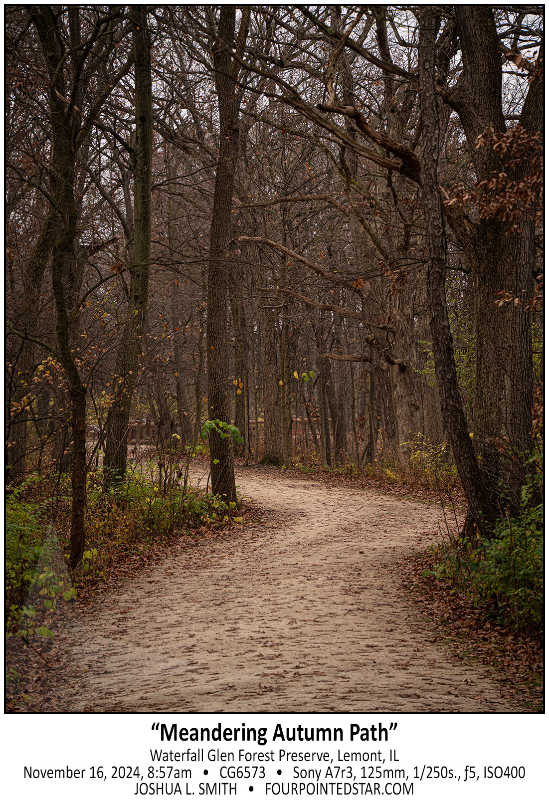
“Meandering Autumn Path”
December 22nd, 2024
photos from joshua l. smith


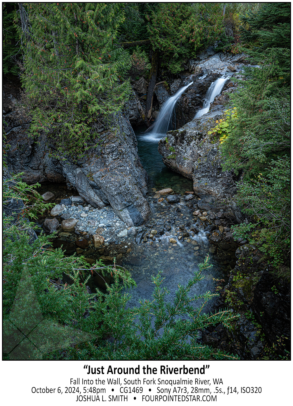
Fall into the Wall was the the best waterfall that we visited on our trip to Seattle. This waterfall is tucked in-between the East and West-bound traffic of Interstate 90 near Snoqualmie Pass. In fact, just out of the top of my photo is the eastbound traffic. Despite being within earshot of the interstate traffic, the setting was perfectly serene. The side road that offers this view is about 20 feet higher than the creek bed and offers wonderful views of the otherwise nearly inaccessible falls. If dusk had not been approaching, I would have stayed for far longer enjoying the horseshoe bend.


This series of falls reflected an incredible decrease in elevation. This is the last segment of large falls, but there is significant series of rapids and cascades even further down the stream and the entire area is filled with incredible sights and scenes.
As we drove out of the woods, I realized that we could park alongside the road and see a part of the falls. Then once we walked to the bridge over the stream, you could see a walkway under the bridge, so of course, I climbed down to the walkway to capture this photo!
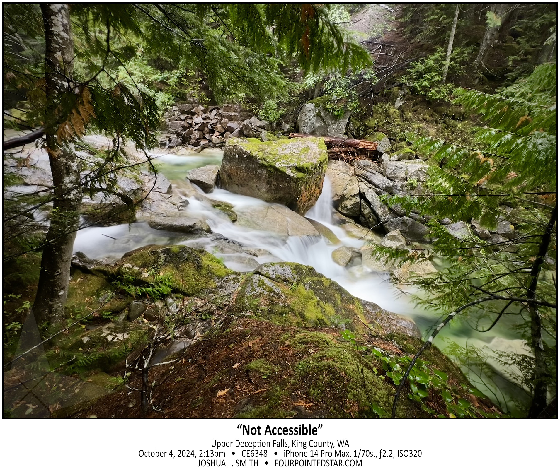
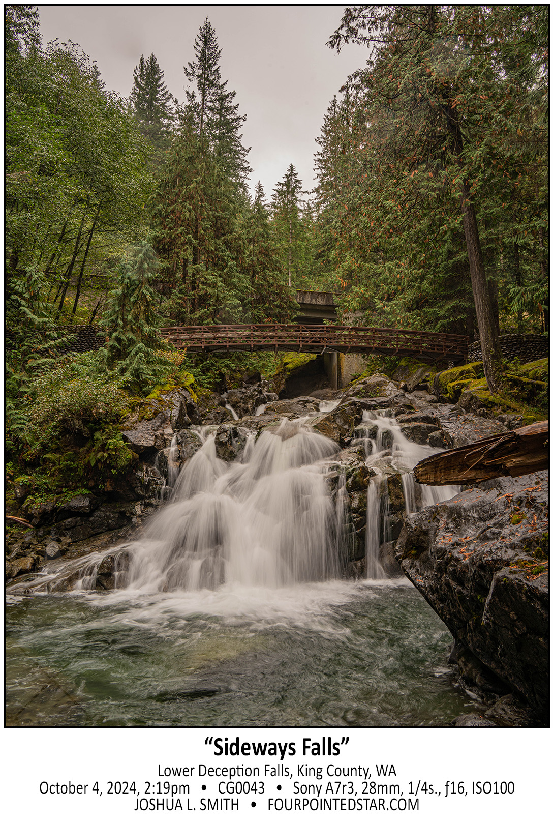
Before our October 2024 trip to Seattle, I bought a “Washington Waterfalls” book and picked out a couple of sets of easy hikes. Our first waterfall adventure was to visit a few that were along Hwy. 2, and at our first stop, the parking lot was closed. After looking at the map, I realized that there may be a different way to see the falls. Technically I was right…technically. As we drove up the dirt road, it got increasingly steep and less likely to lead to an accessible path.
We parked precariously, and I clambered down the hill to see if I could get a photo. The water was a crisp bluish-green, and since it was raining that morning, I was not comfortable with crawling all over the rocks like normal, but even from my vantage point, the scene was incredible.
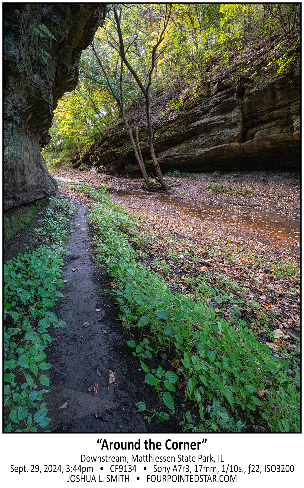
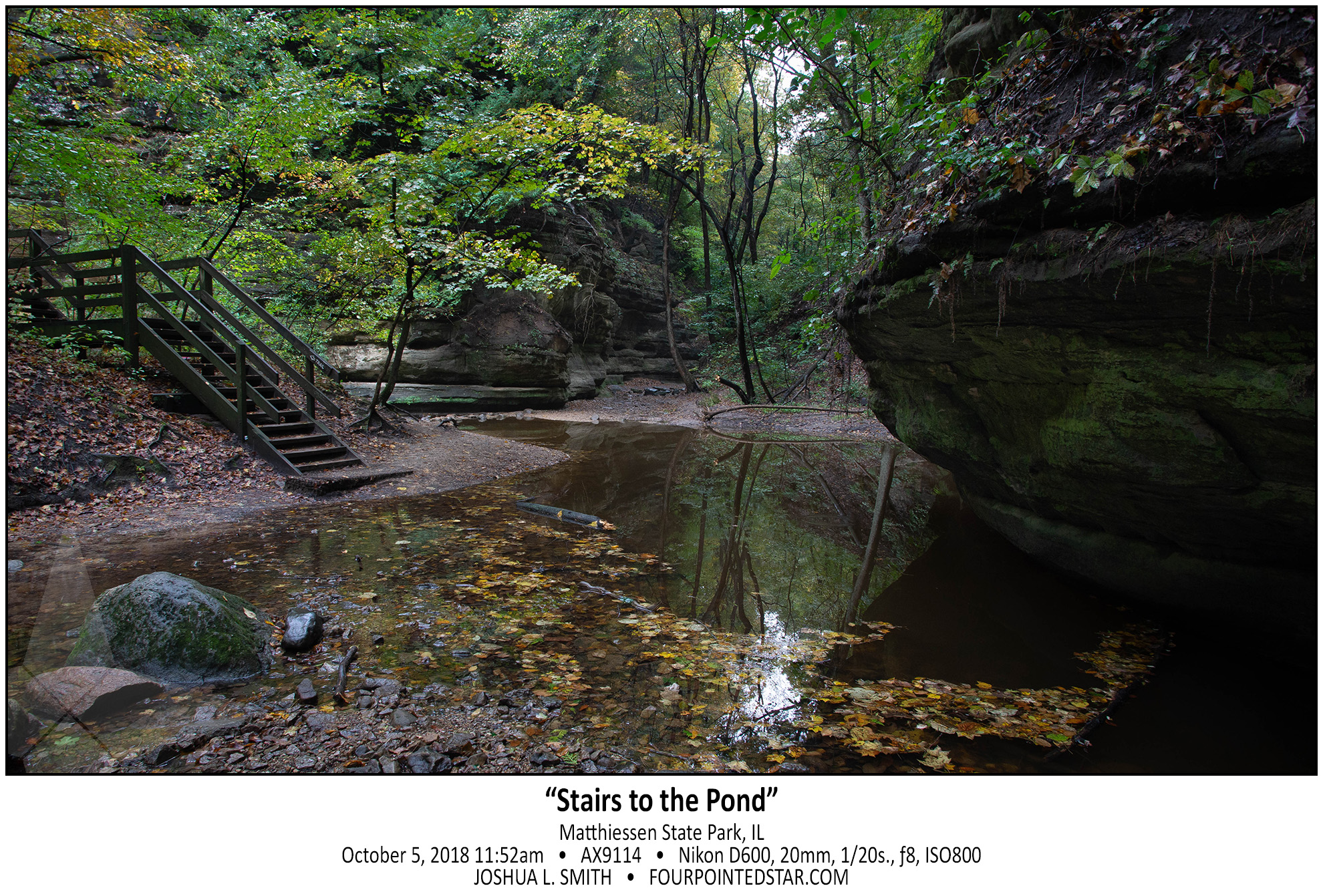
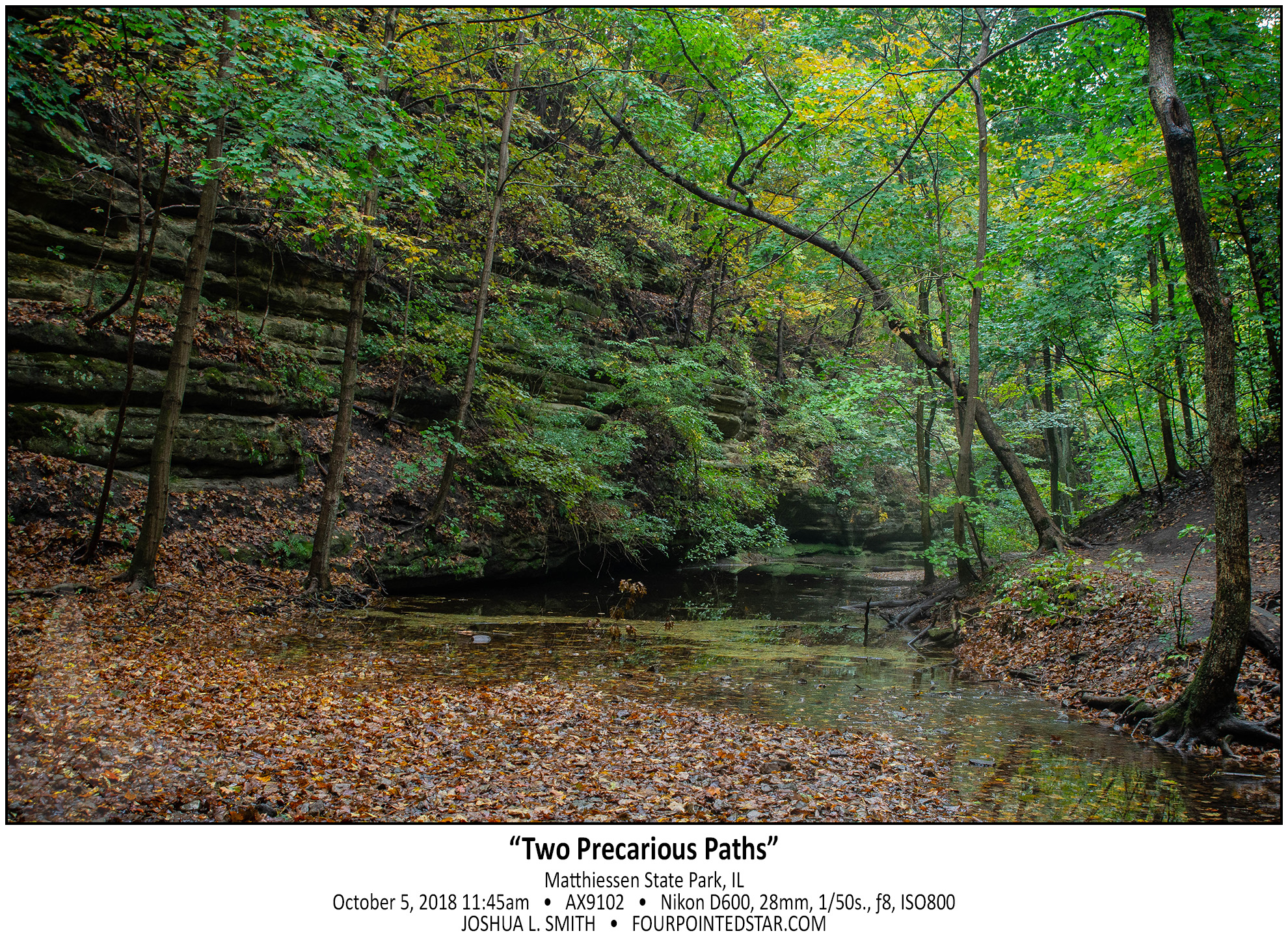
Just fair warning, if it has rained recently, and you decide to walk downstream at Matthiessen, your feet will get muddy or you’ll walk in the streamed itself. And maybe both…

My daughter and I visited Matthiessen back in 2018, and we walked upstream that time. So this time, we visited the main waterfall area; then we walked downstream this time – all the way to the Vermilion River. The Devil’s Paintbox is right by the main stairs down to see the main waterfall area, and honestly, it’s not that exciting except for the copper colored stream that was very slowly flowing out of the alcove.
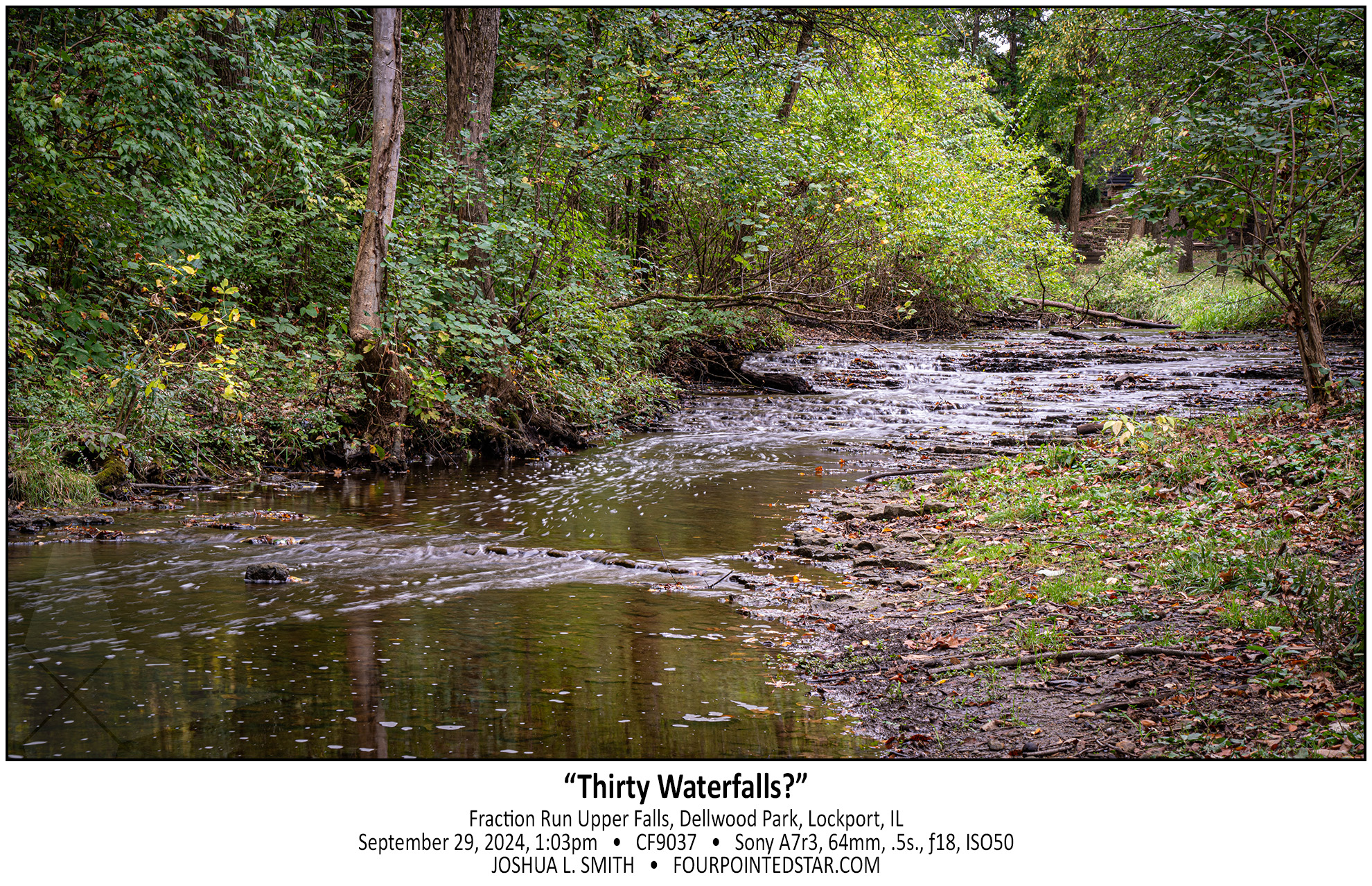
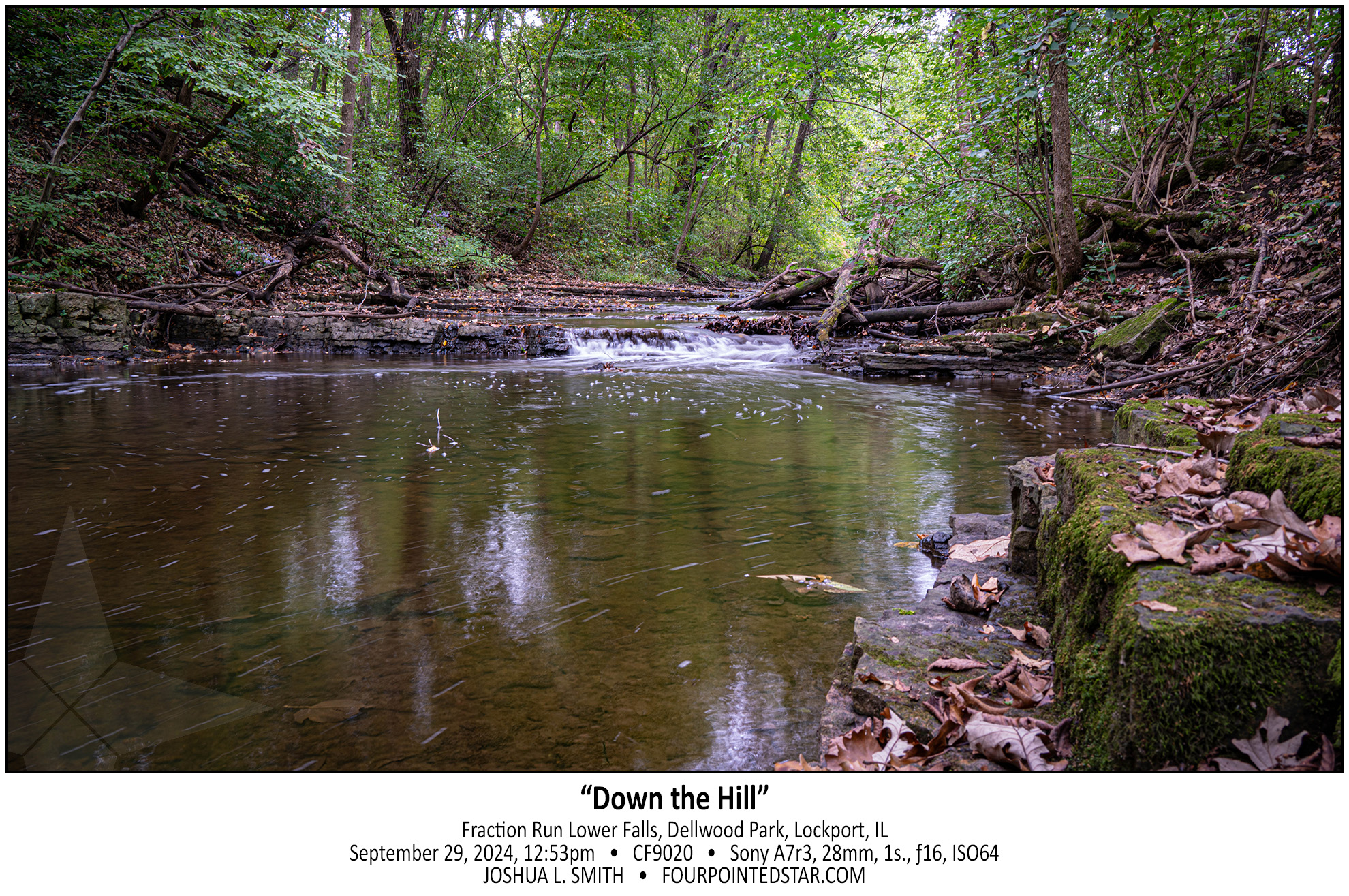
Not only did we find a waterfall in Dellwood Park along Fraction Run Creek, we found two! This waterfall is probably widely known – it’s right on the frisbee golf path; the other waterfall is a little harder to get to. There are likely more drops as well, but they would only be accessible by walking through the stream.
I’ve written a few times about “what is a waterfall”, so I would ask – Is this 1 cascade or 30+ individual falls? 🙂
While I was visiting Sagawau in Cook County, one of the park employees mentioned that there may be a waterfall in Dellwood Park in Lockport. Since I have a client in Lockport, I already knew that there was a stream in a valley in Dellwood Park, and I was disappointed that it hadn’t occurred to me that there was likely to be a waterfall in that valley. So, the next available weekend, my oldest daughter and I went on a hike to see if we could find a waterfall along Fraction Run Creek…
I have 3 waterfall books that indicate that there is a waterfall or at least a larger rapids on this stream, and one of the books indicates that it is easy to reach. Without climbing down into the stream and then walking under the concrete culvert, I can’t tell if there is anything upstream. I also am VERY hesitant to walk upstream without knowing or seeing some indication that the land is still undeveloped at the least. So, this rapids/waterfall/something waits for another trip.
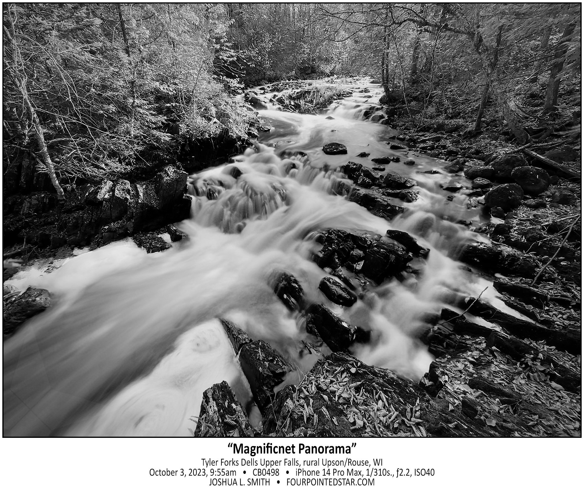
As I crested the hill so that I could see the rapids behind, I was literally awestruck by the view of Tyler Forks Dells Upper Falls. I gasped something like “that’s incredible!” as the scene came into view. The guide that I had stated “a series of small rapids forming an S curve”, but did NOT prepare me for how beautiful the Upper Falls are. The falls at the rear of the image are probably 200-250 feet away, which provides you with a sense of how expansive this view is. Although, you can’t tell it in this monochrome, the pops or orange leaves on the dark rocks, the yellow foaming water, and the sunlight illuminating the far side of the river added to beauty.


There are definitely times of the year when Upper Bear Hollow Falls are flowing enough to be impressive, but early April is not one of them.
…view older images with the thumbnails below…


…view older images with the thumbnails below…


Just a little trickle of a falls that I captured on my way back from the eclipse earlier this year. This waterfall would probably not make it onto anyone’s map or highlights, but at 3 to 4 feet tall, it is just a fun little falls to enjoy.
…view older images with the thumbnails below…


…view older images with the thumbnails below…


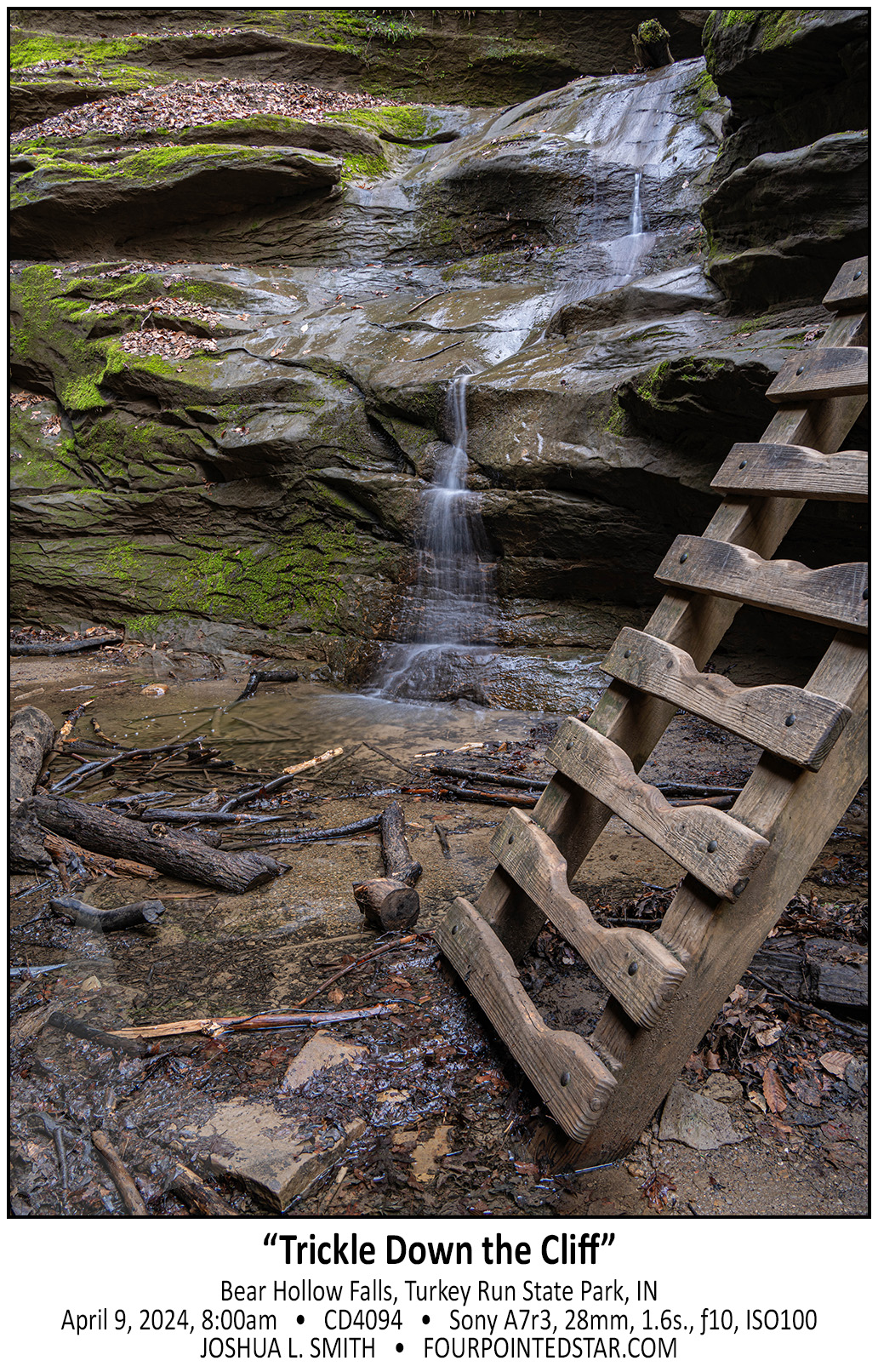
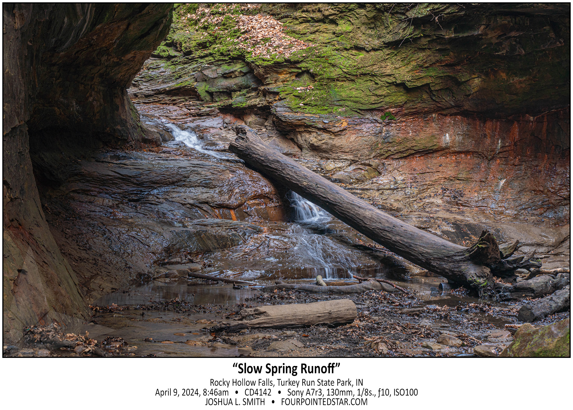
When I visited Turkey Run State Park the first time, back in 2022, I ran out of time and walked right past Bear Hollow without capturing any photos. However, the first photo that I saw from Turkey Run was from Bear Hollow with its iconic ladders – so adding Turkey Run and Bear Hollow to my return trip was an easy decision.
…view older images with the thumbnails below…


…view older images with the thumbnails below…


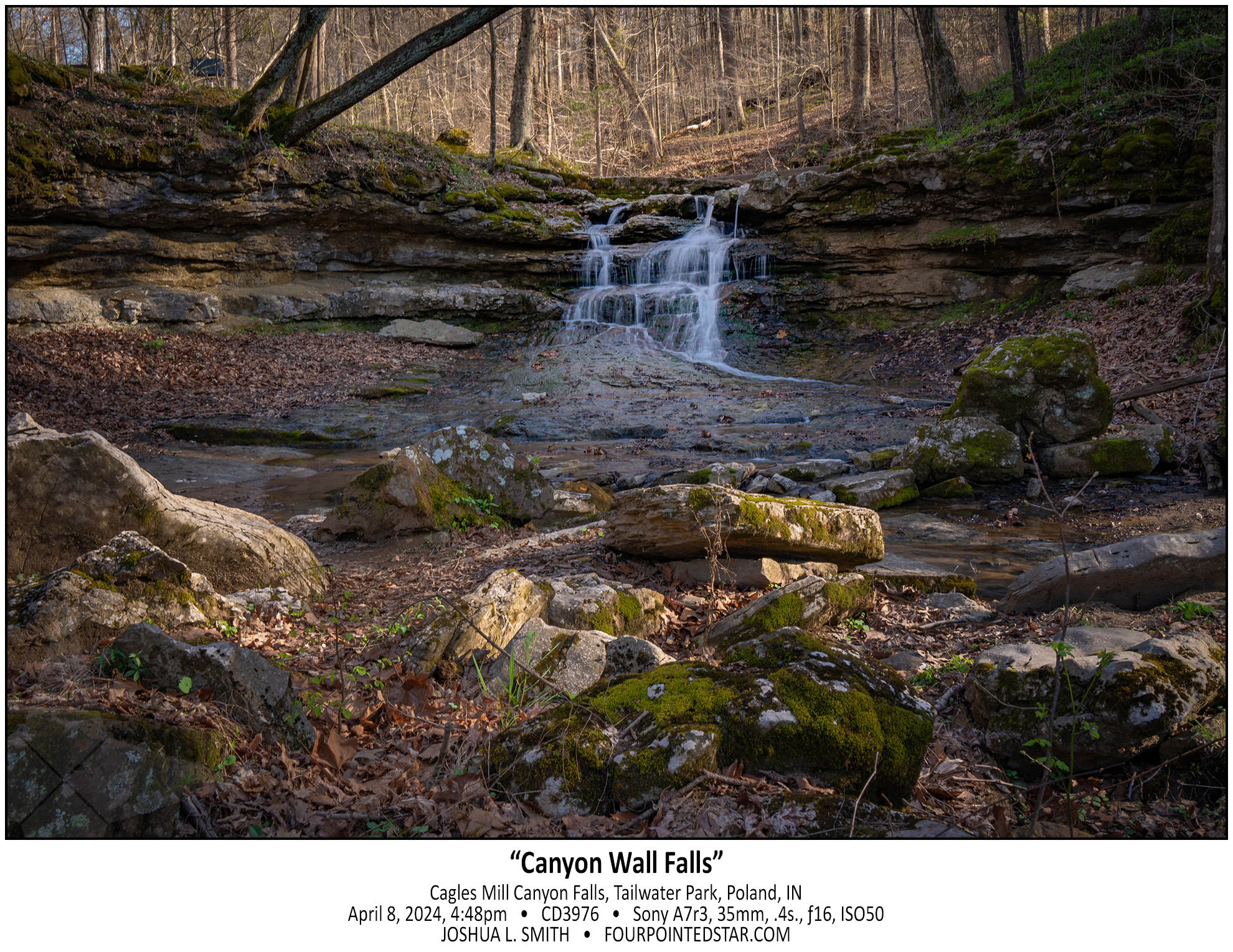
As I headed north from Cataract Falls to Turkey Run, I mostly meandered through the back roads. On one road there was a sign “Cagles Mill Dam” pointing to a side road. The road ended right before it crossed the top of the dam wall; honestly, it was a pretty impressive view. But I noticed that the downstream area appeared to be a rocky canyon, and as I drove down to the bottom of the damn, I was rewarded with this tiny waterfall – maybe a total of 4 or 5 feet tall.
…view older images with the thumbnails below…


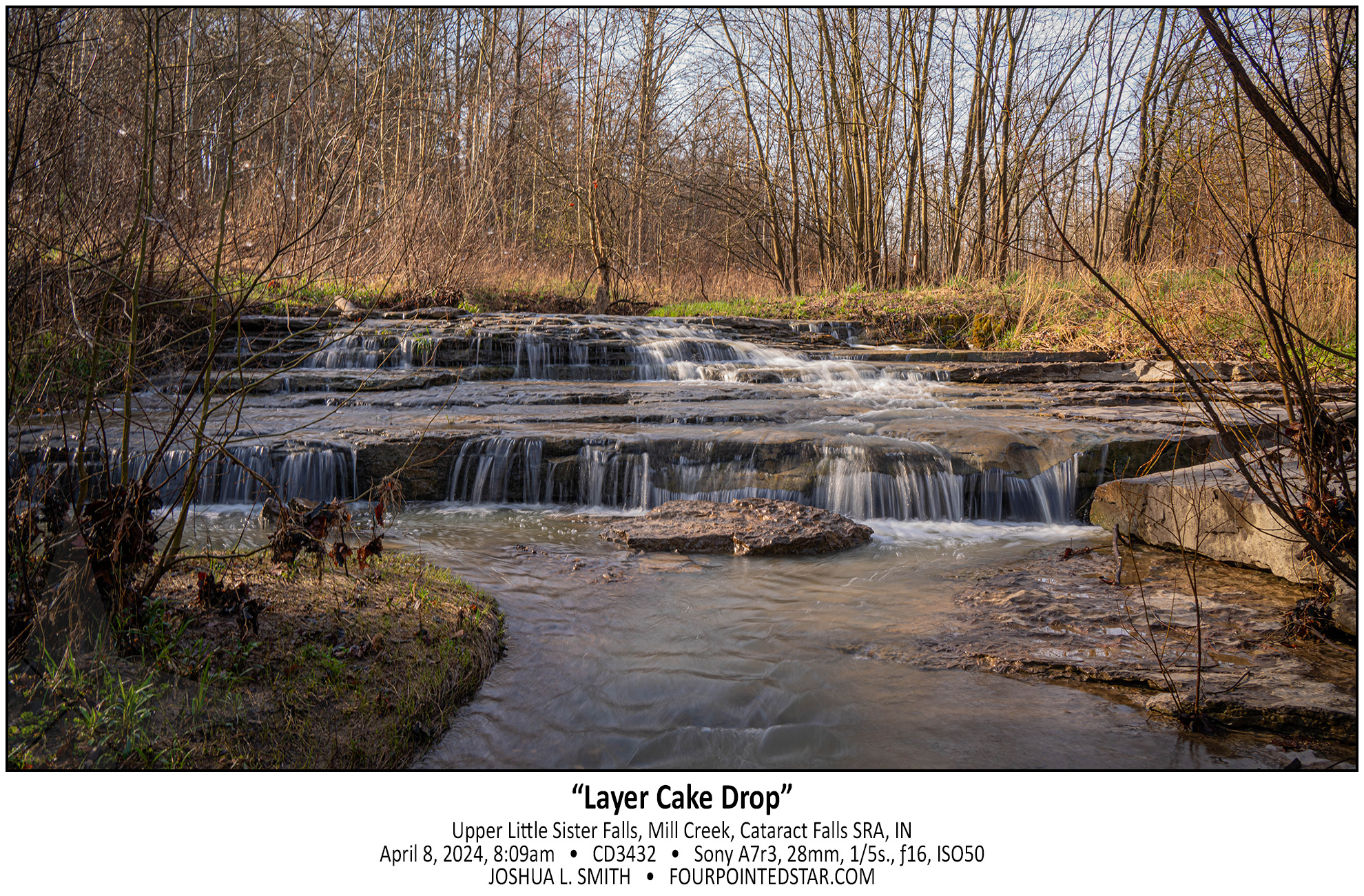
When I arrived at Cataract Falls in Indiana, I asked one of the park rangers if she knew of other waterfalls in the area. She pointed out that if you walk AWAY from Mill Creek (and Lower Cataract Falls), you’ll encounter Little Sister Falls. Little Sister Falls ended up being 2 distinct small cascades about 60 feet apart; the perfectly intimate waterfalls that I love being near.
…view older images with the thumbnails below…


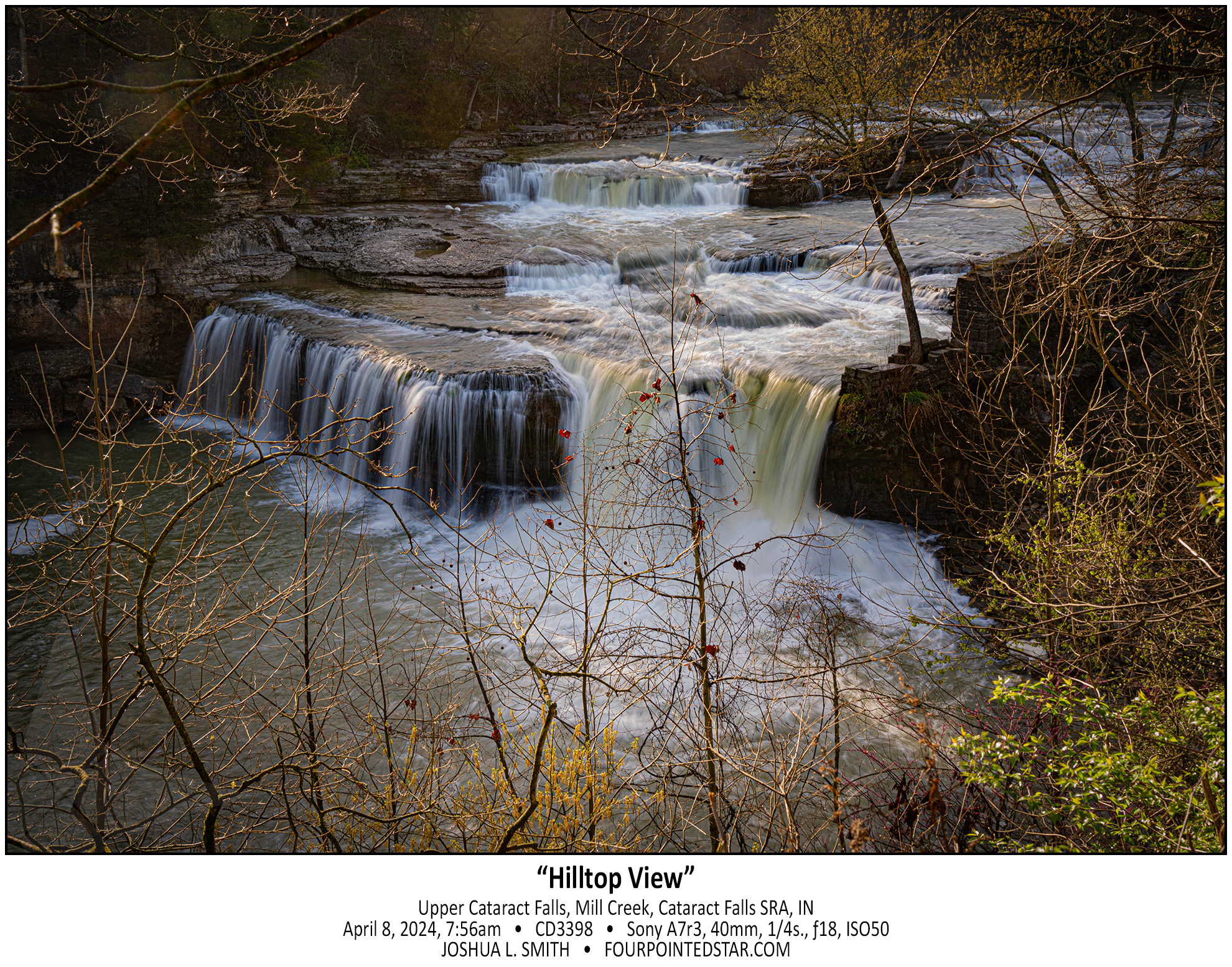
Upper Cataract Falls is listed as the largest waterfall in Indiana (by volume); it wasn’t easy to photograph due to the vegetation, but it would likely be even harder to photograph when the vegetation has filled in.
…view older images with the thumbnails below…


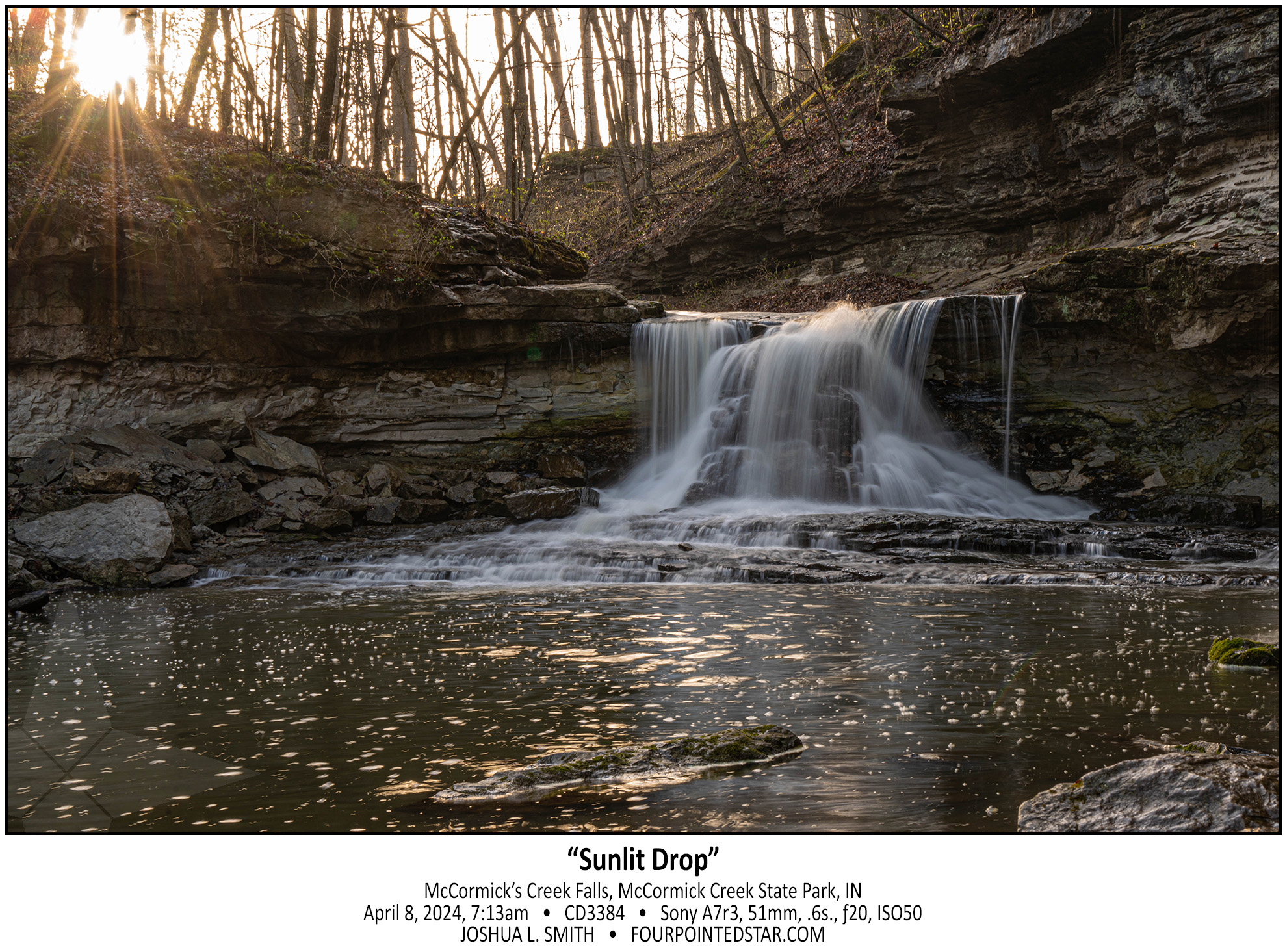
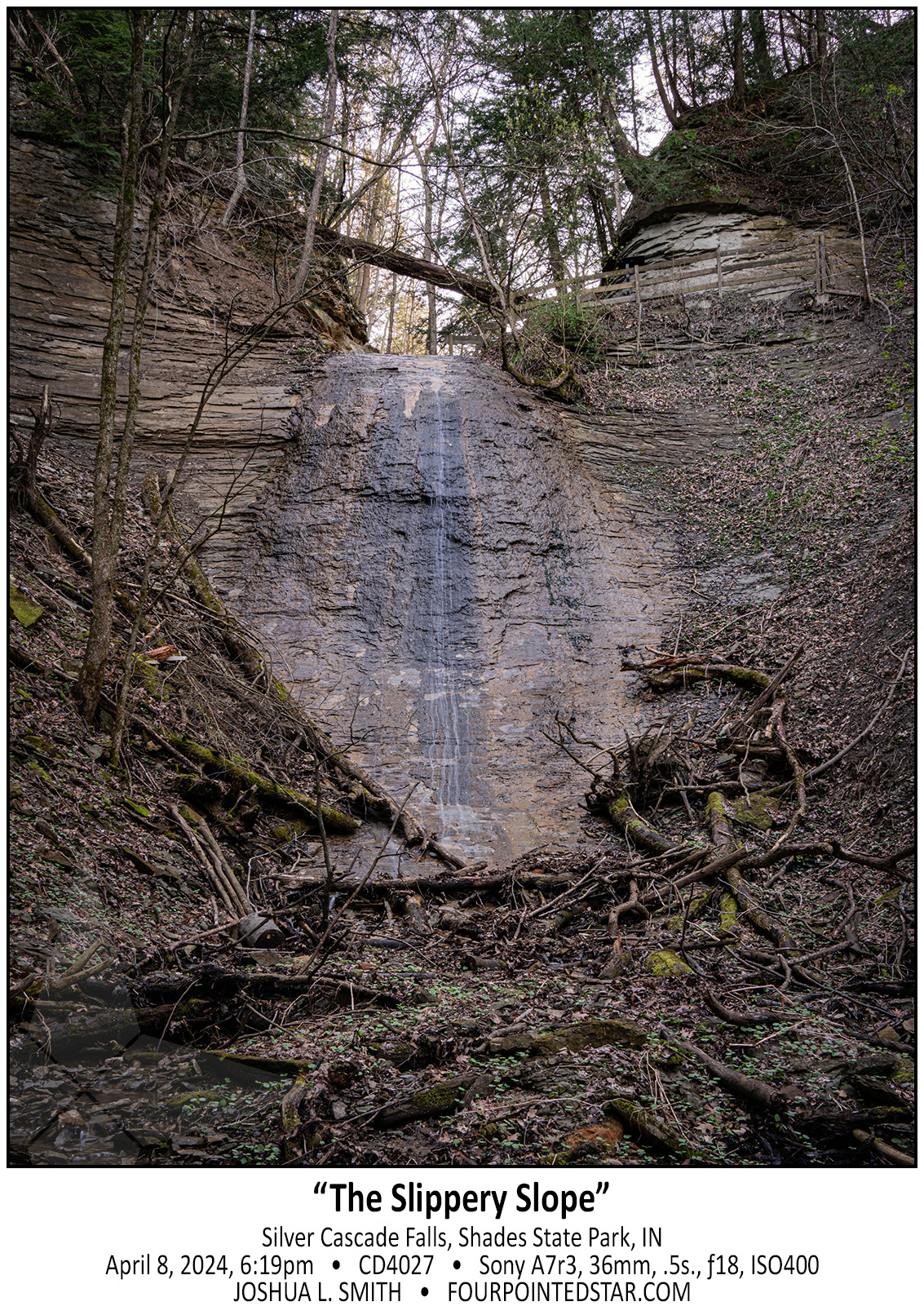
Why yes, of course, I did visit several waterfalls while I was in southern Indiana for the eclipse. I am legally obligated to visit waterfalls anytime that I travel farther than 45 miles from home.
…view older images with the thumbnails below…


What an odd viewpoint – looking north down the Black River after Rainbow Falls, you can see a straight(-ish) river for about half of a mile, before the river turns and enters the Black River harbor.
…view older images with the thumbnails below…


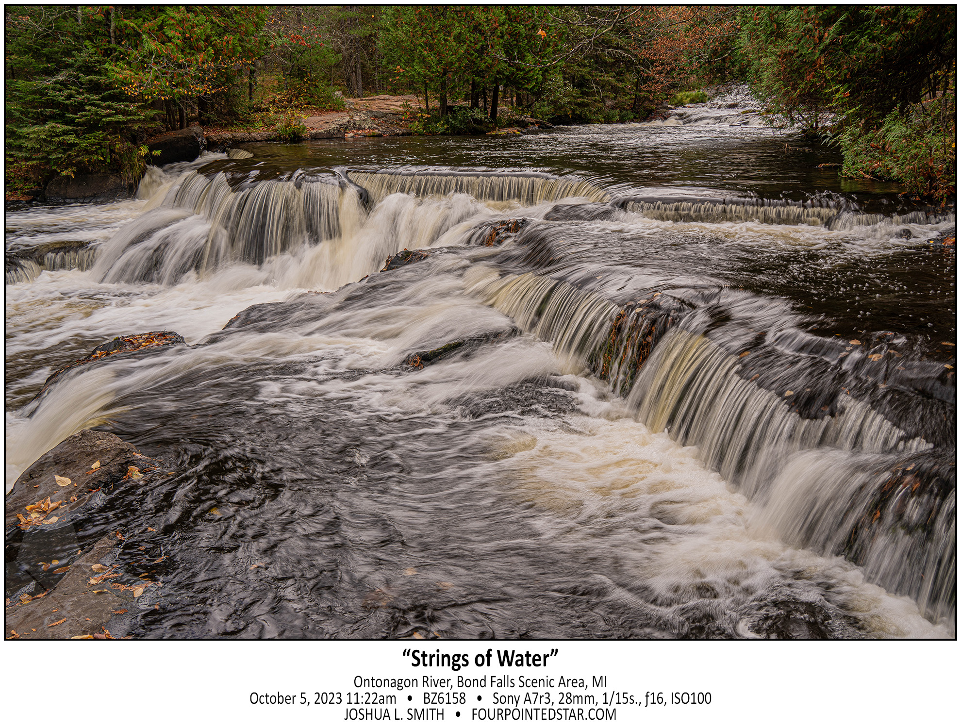
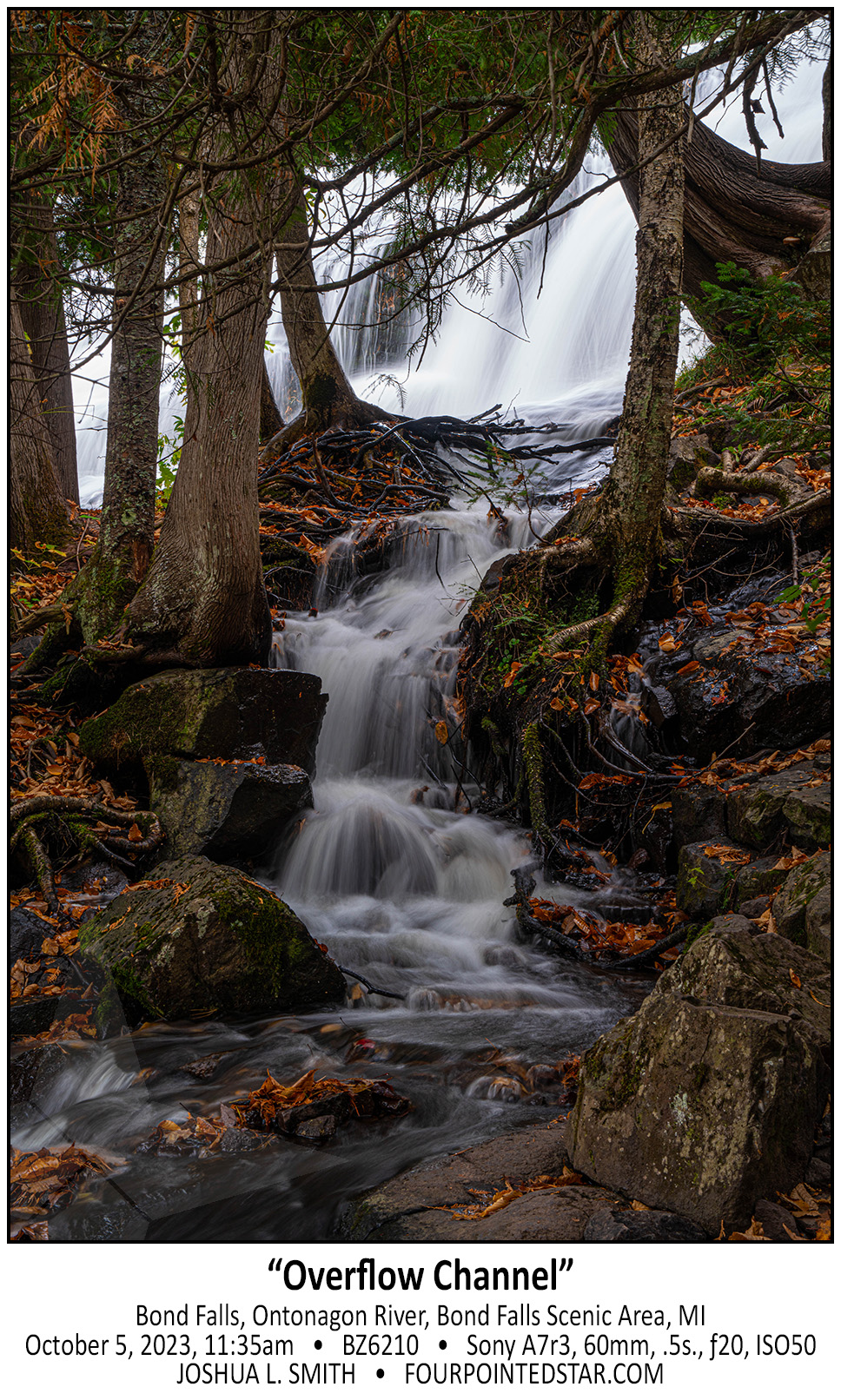
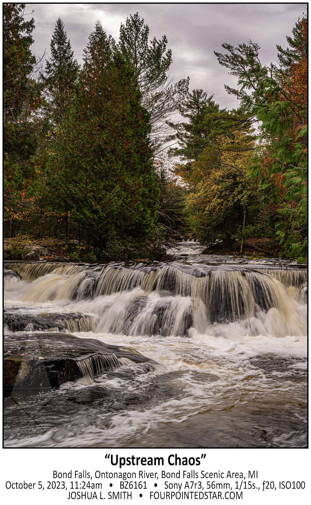
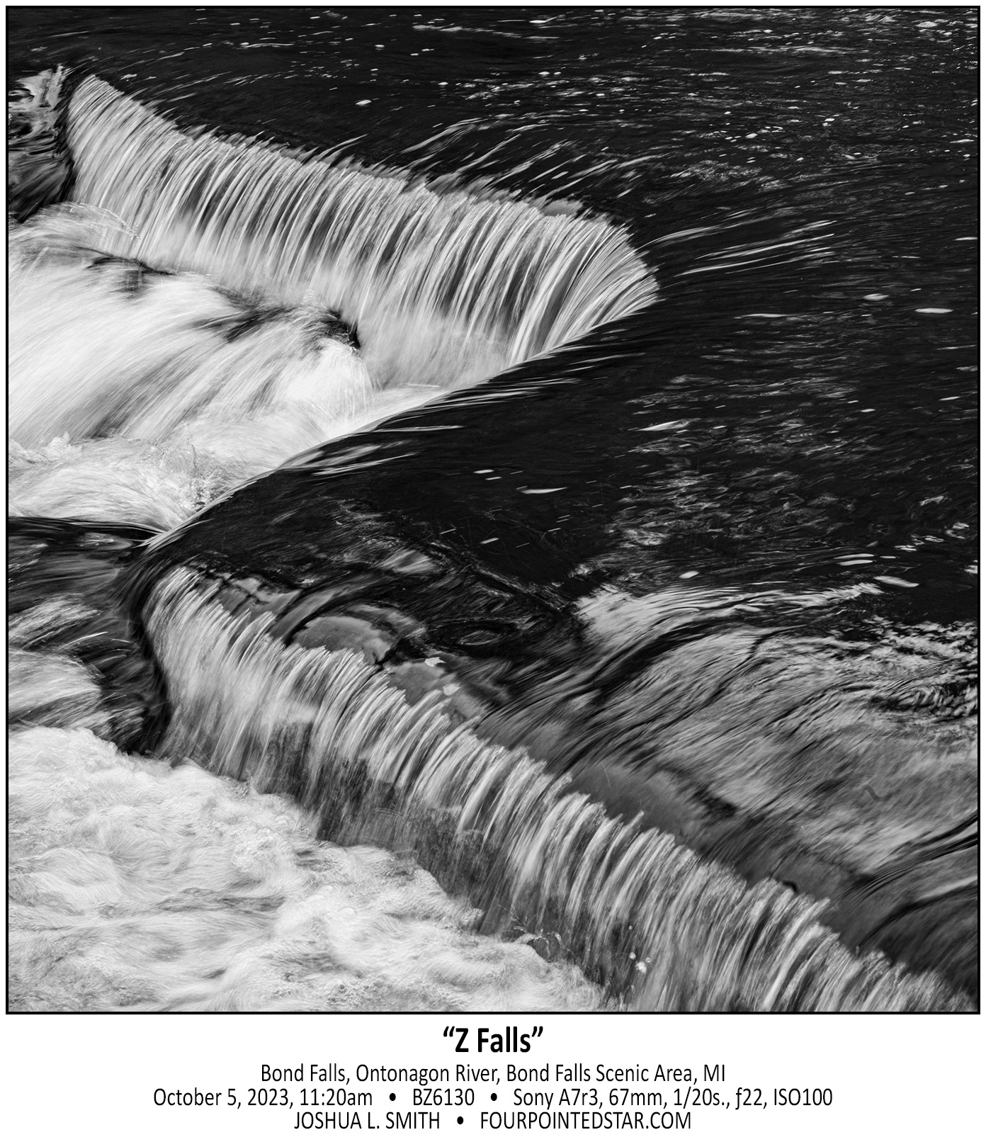
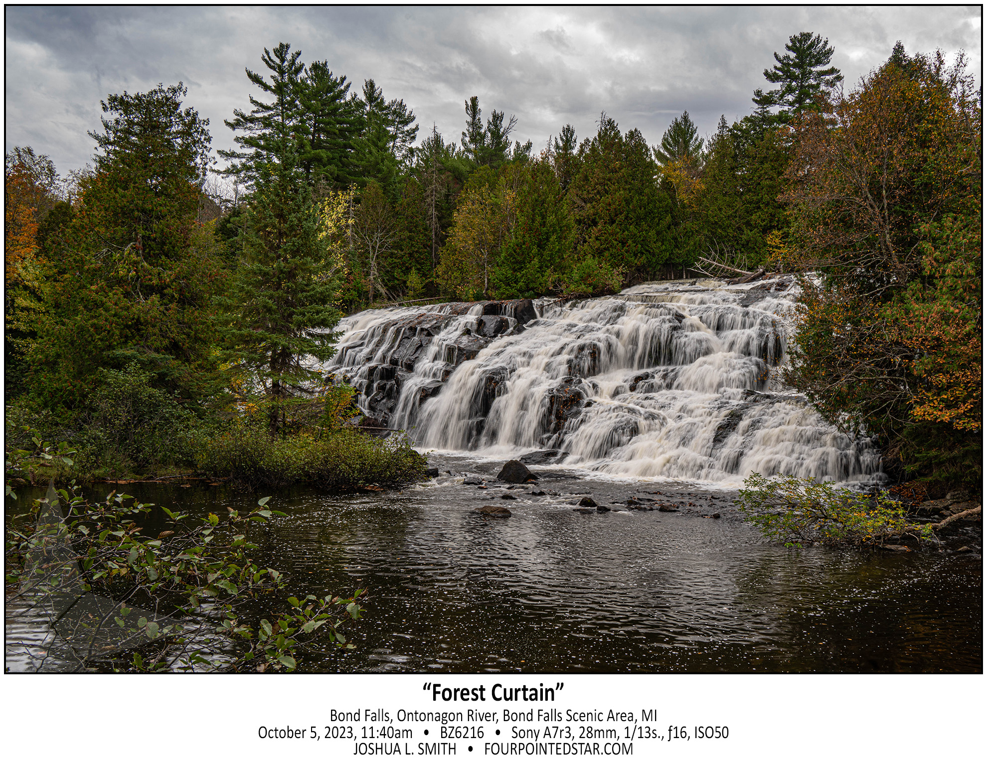
Quite honestly, you could spend several days photographing the area of Bond Falls. The falls itself is actually several falls over a few hundred feet of stream, and the internet says that it drops roughly 50 feet in elevation.
…view older images with the thumbnails below…


…view older images with the thumbnails below…


…view older images with the thumbnails below…


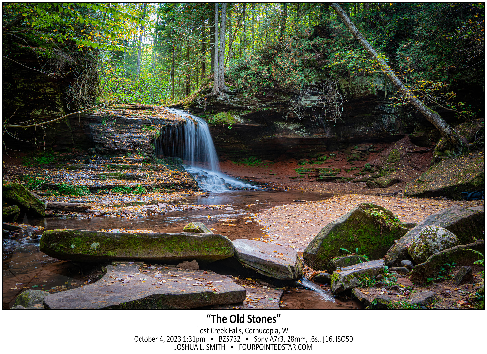
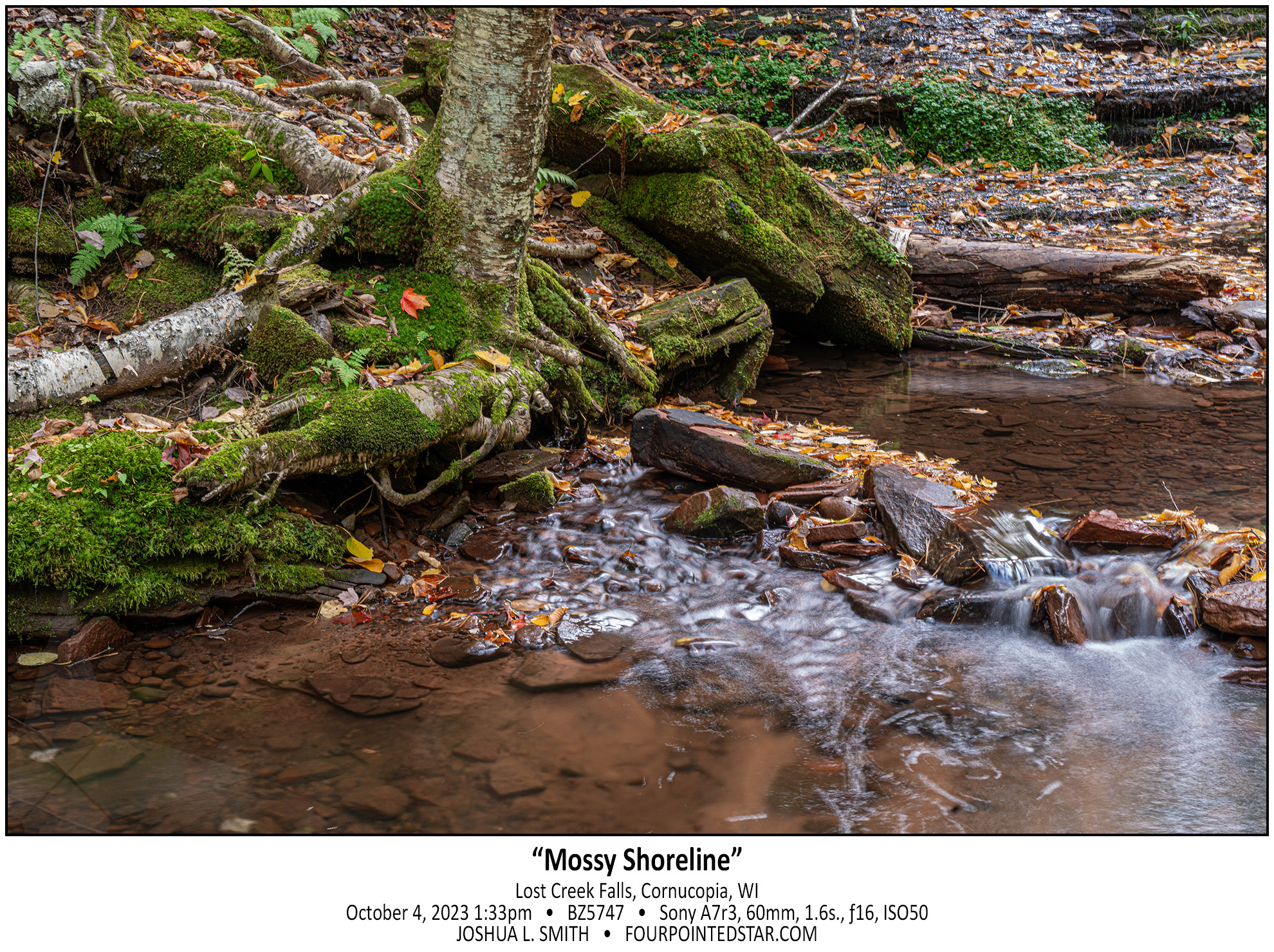
Lost Creek Falls might have been my favorite falls from the trip. There really wasn’t much water coming over the falls, but the scene was so peaceful. I’ve walked to many waterfalls, and while they’re in the woods, you can still hear portions of civilization – a truck downshifting, someone mowing, or something else.
This area of Wisconsin is very rural, and then you have to walk about 2 miles to get to the falls through the forest, so there is simply no noise other than nature.
…view older images with the thumbnails below…


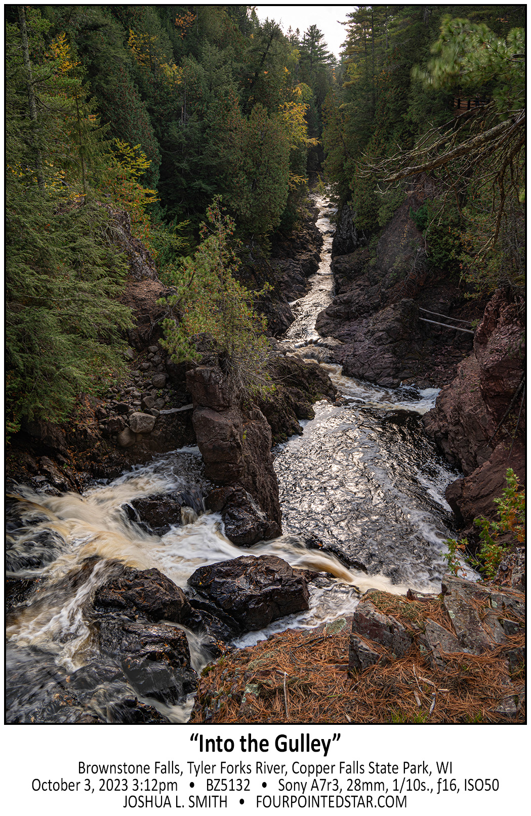
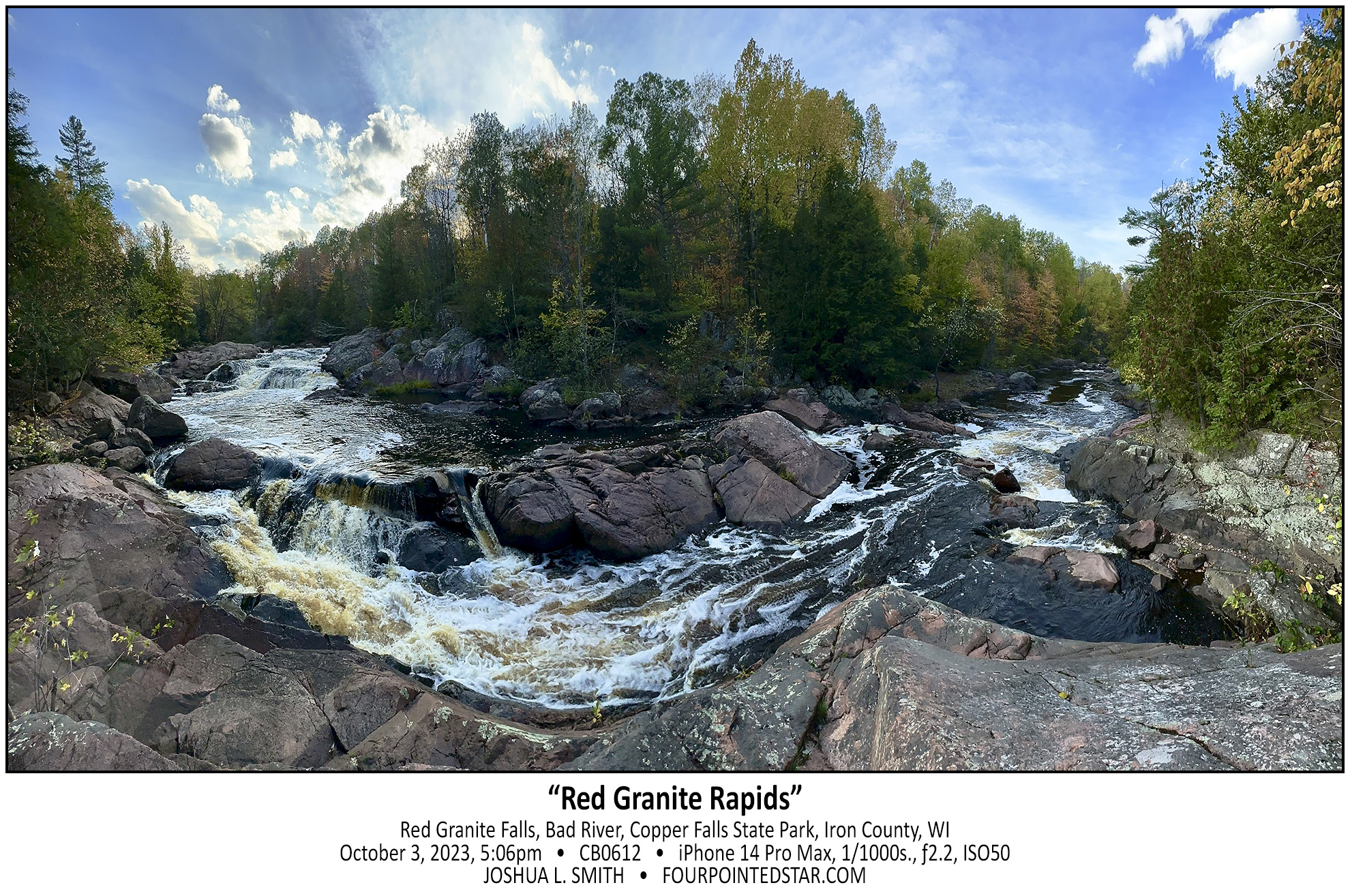
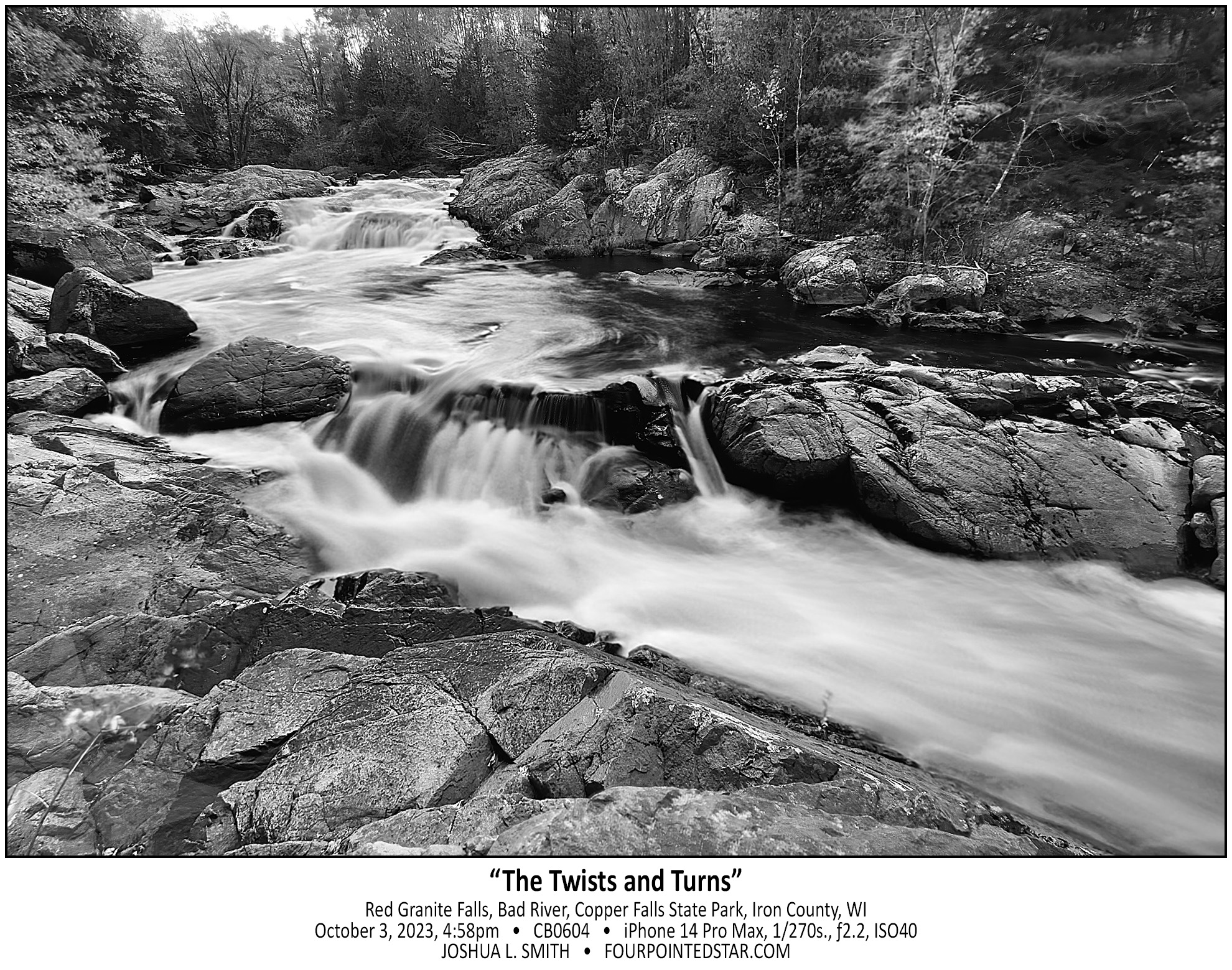
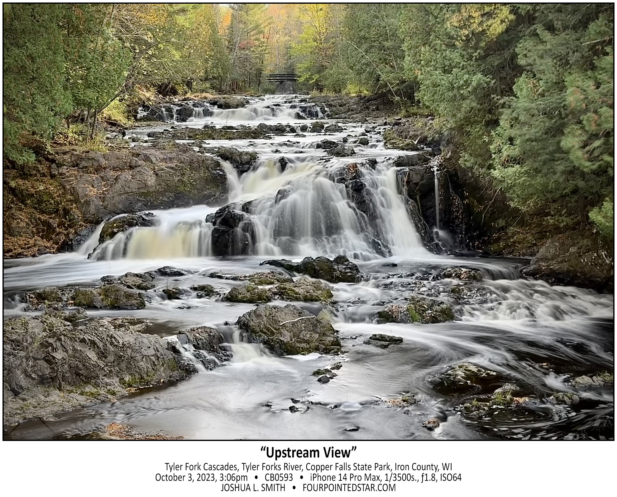
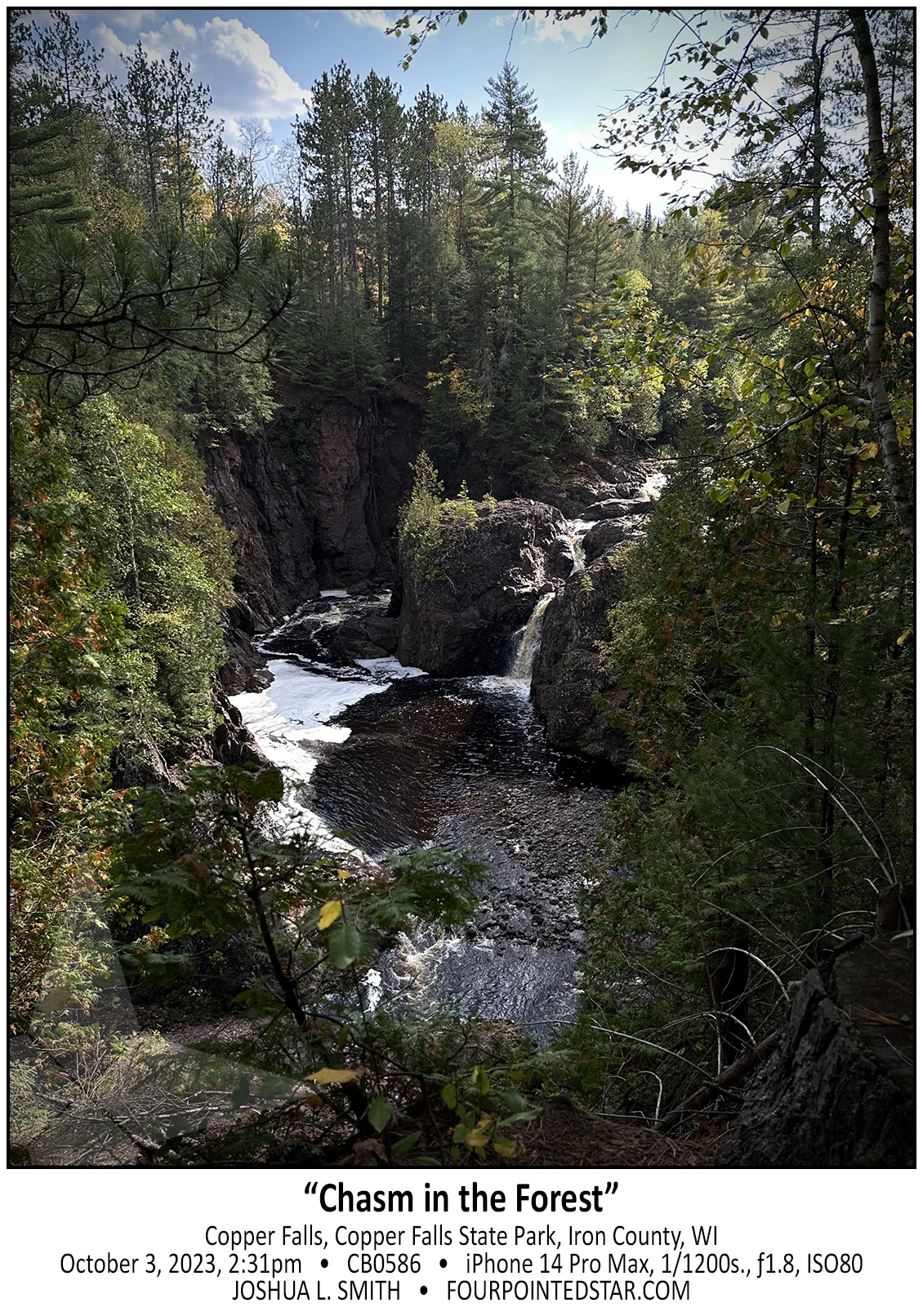
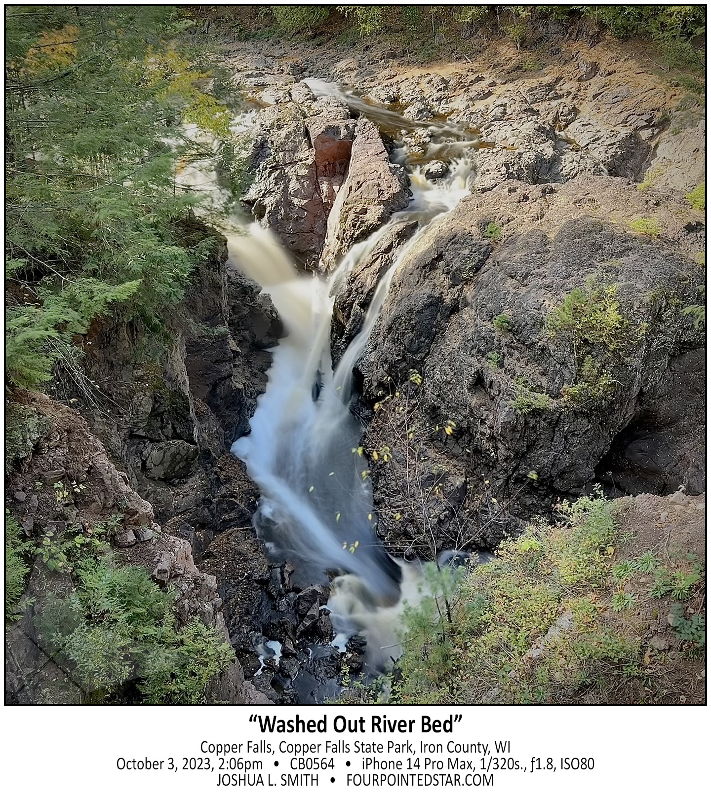
I’m back to those photos from my October waterfalls trip – Copper Falls State Park is absolutely incredible; four waterfalls with so many great trails too! The main entrance to the parking lot is up that river channel, and you’re actually looking upriver in this photo. But what you can’t see is the 10ft falls at the bottom of the image, and the 35ft Brownstone Falls just a little farther onward. It was a very impressive view, and someday I’ll have to go back and take a lot more time to wander.
You can see all of my images from Copper Falls here.
…view older images with the thumbnails below…


…view older images with the thumbnails below…


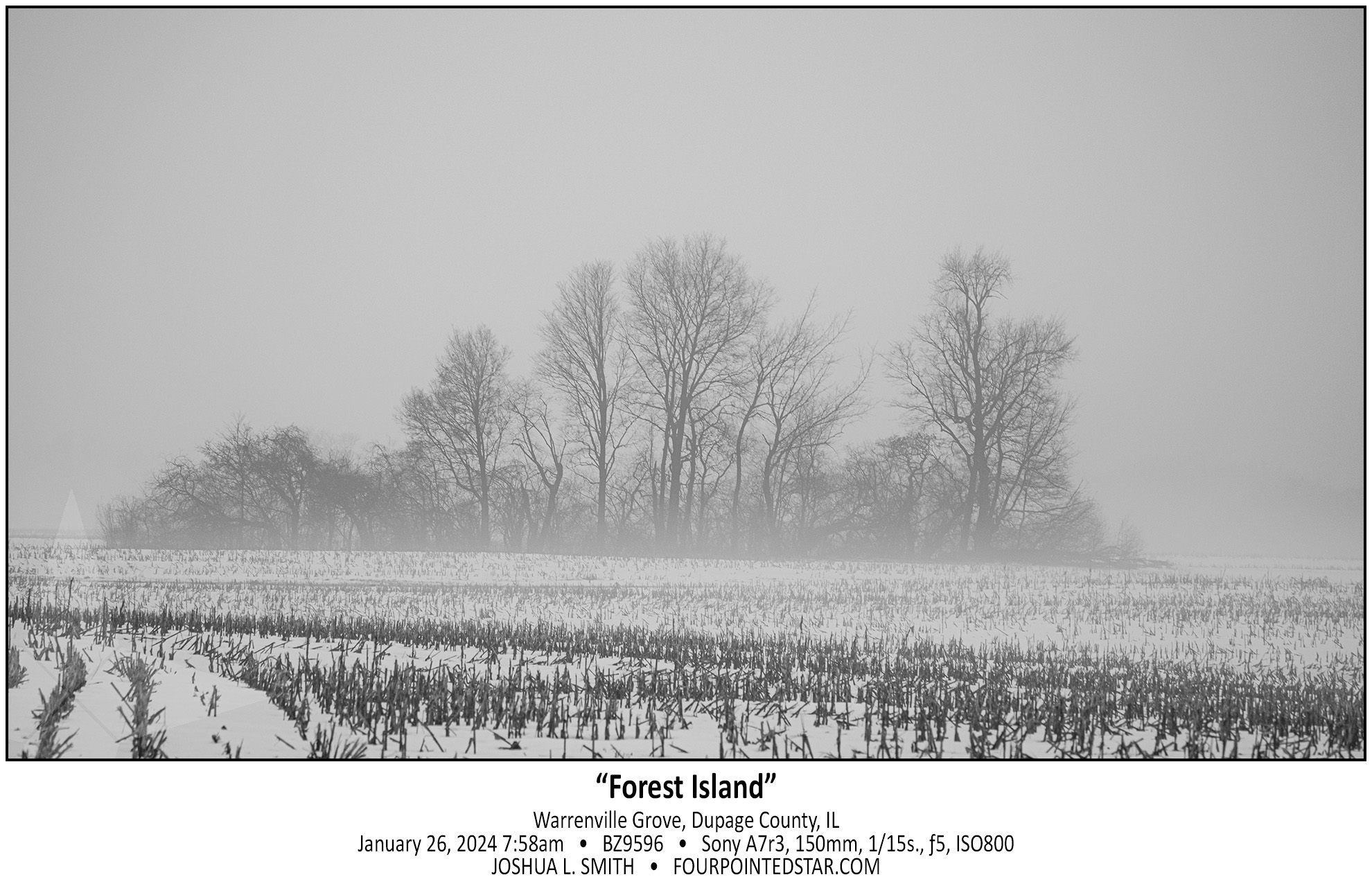
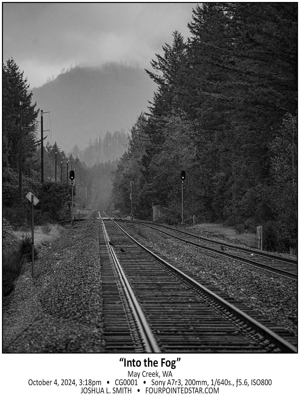
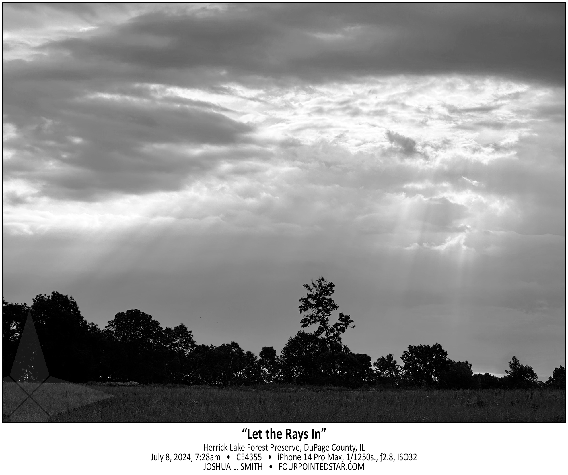
I drive past these wide open fields every morning, and in the winter they are typically very boring. But on Friday morning, the fog was perfect; just dense enough to conceal the horizon, and just thin enough to show the small patches of forest in the middle of the flat fields.
…view older images with the thumbnails below…


…view older images with the thumbnails below…


…view older images with the thumbnails below…


…view older images with the thumbnails below…


…view older images with the thumbnails below…


…view older images with the thumbnails below…


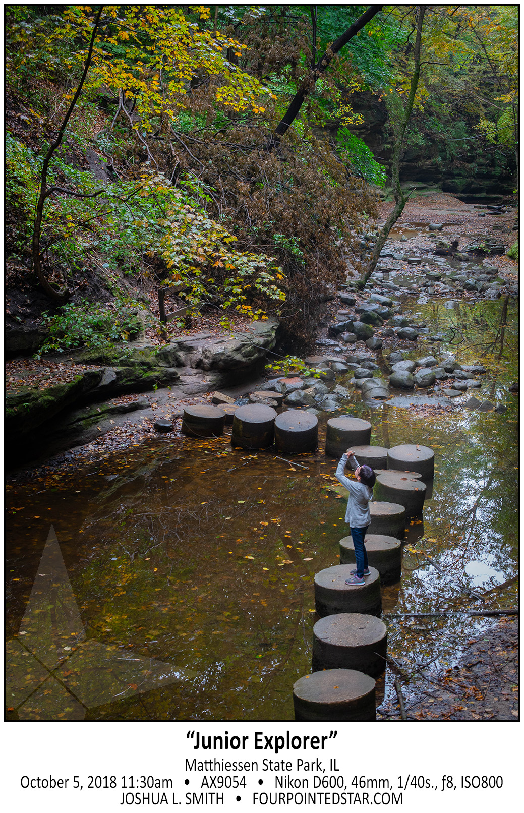
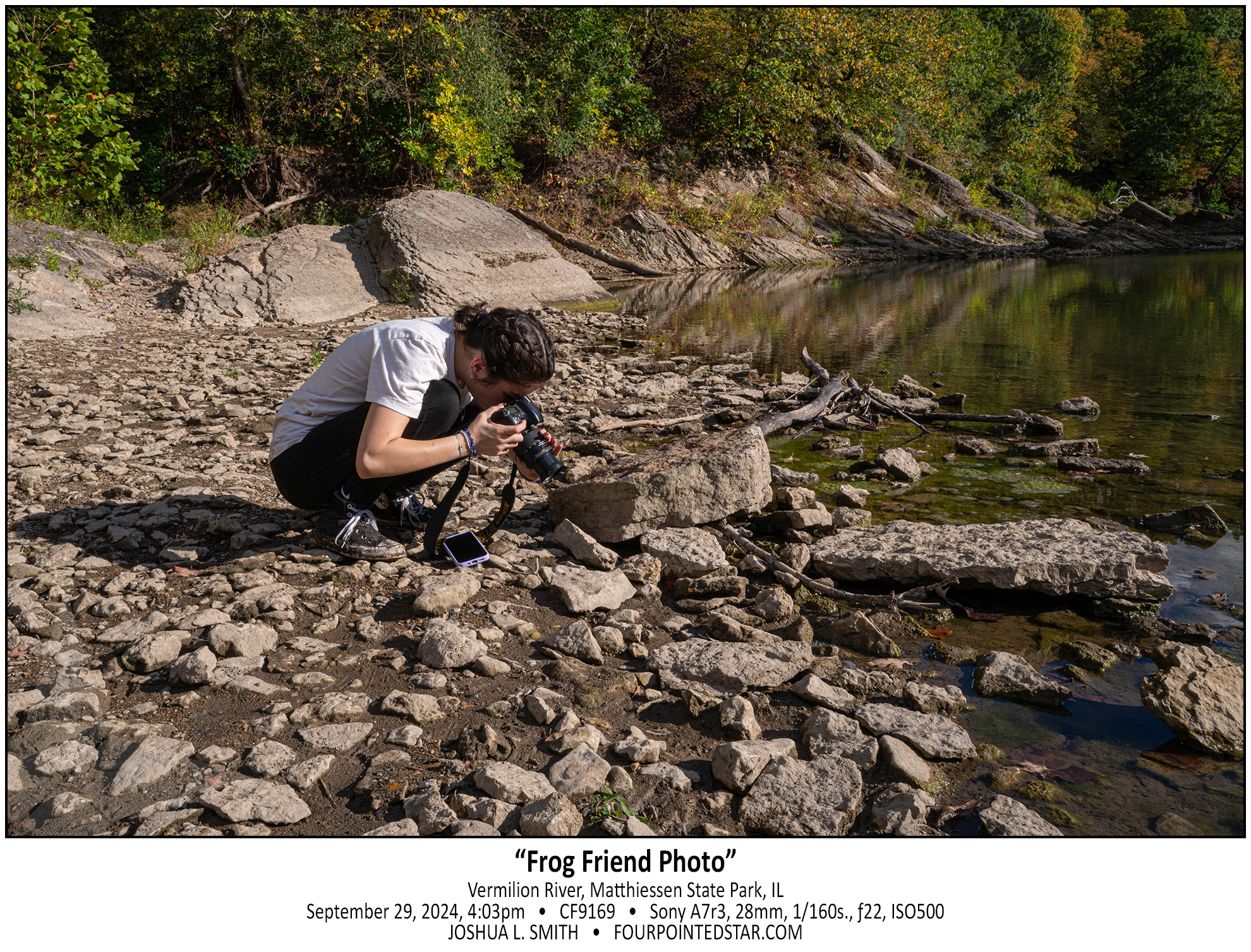
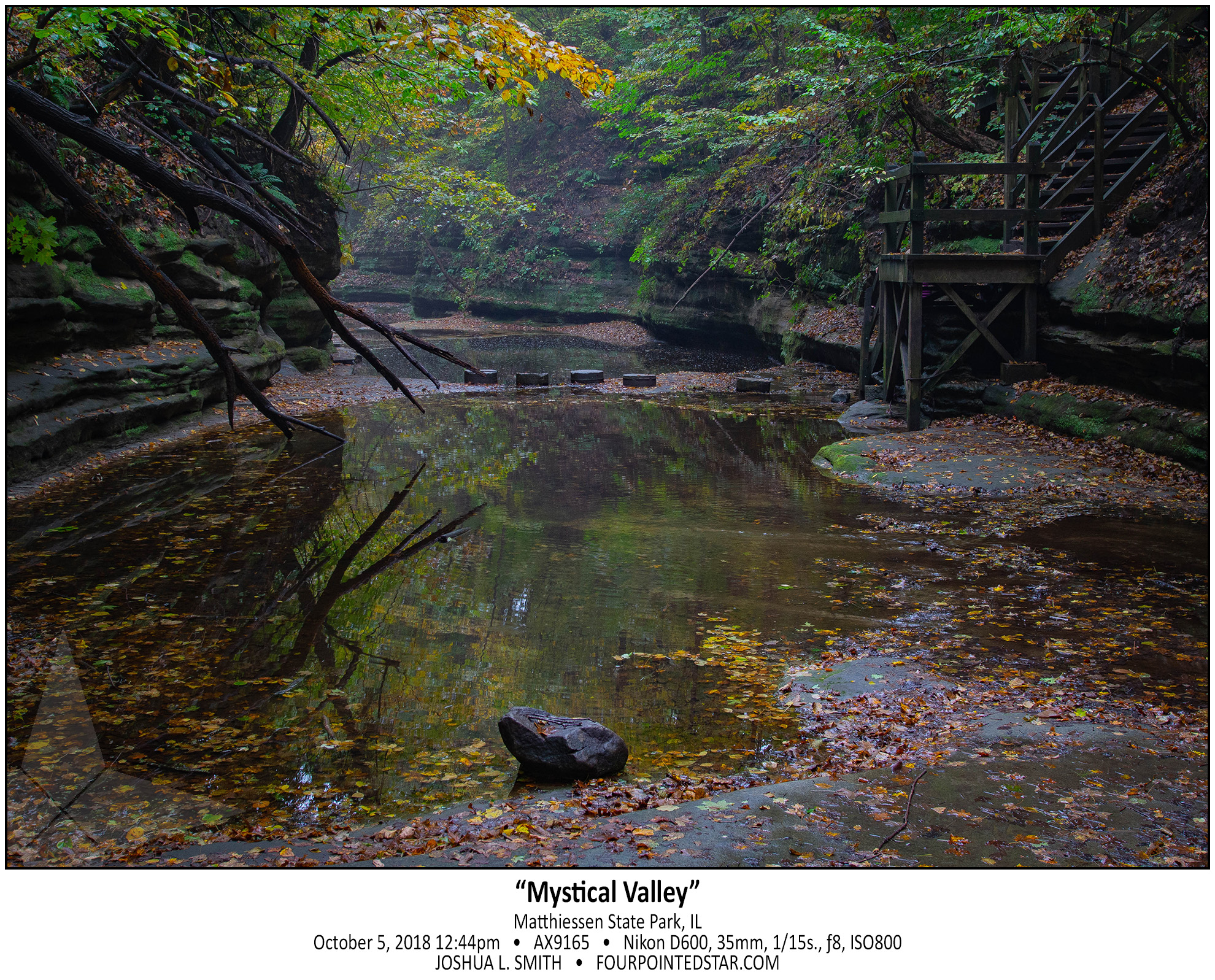
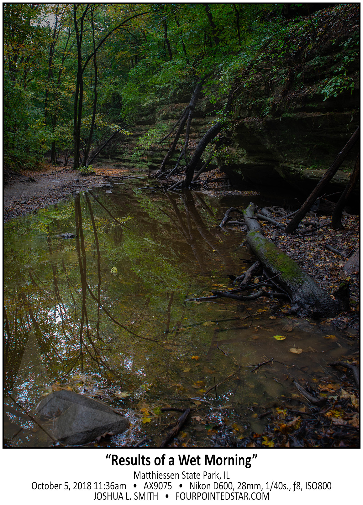
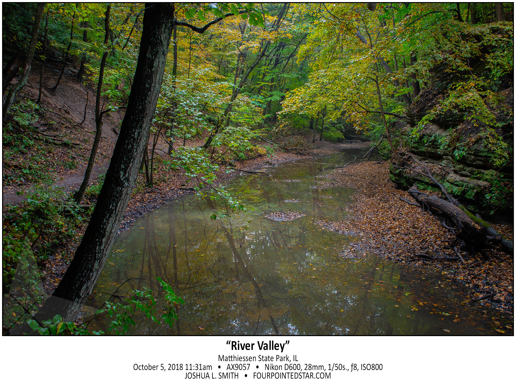
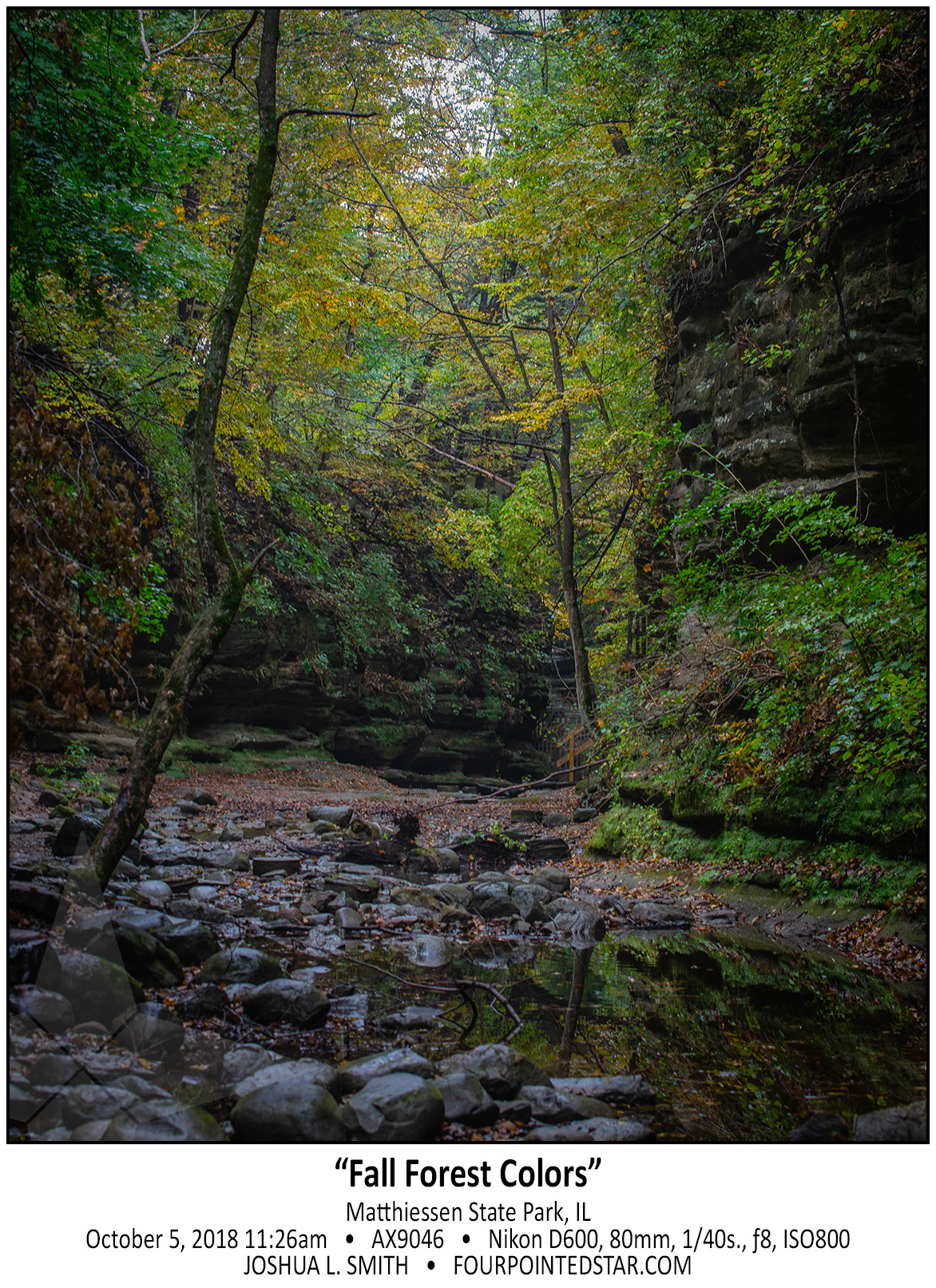
Cynthia and I share the same birth month and when she was younger, we would plan trips for our birthdays. This was a hiking trip to Matthiessen State Park; evidently I never posted all of the photos. You can see the other images here.
…view older images with the thumbnails below…


…view older images with the thumbnails below…


…view older images with the thumbnails below…


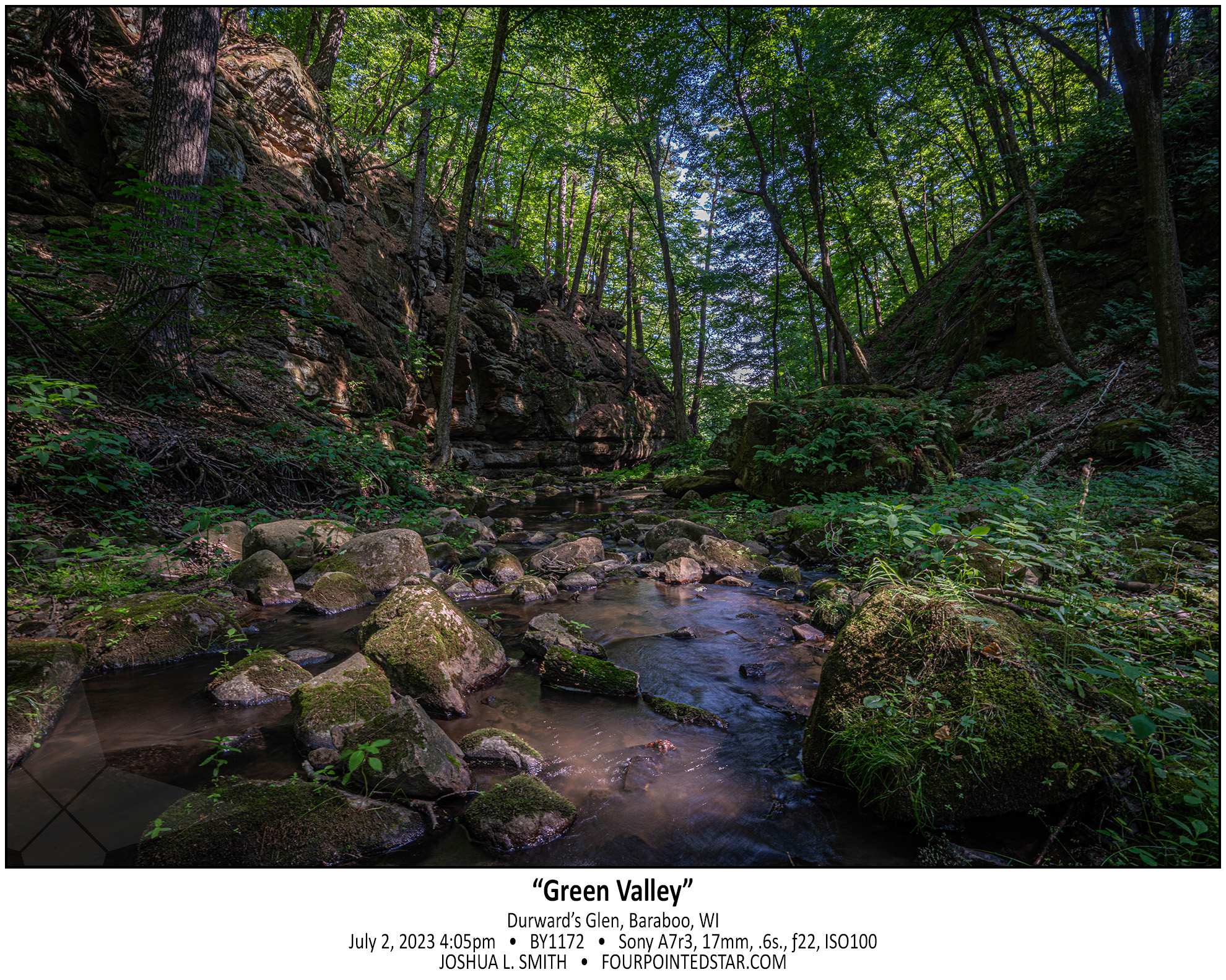
I had not originally planned on visiting Durward’s Glen Waterfall on my July trip, it just happened to be “along the way”. However, just the canyon was well worth the trip; it was absolutely gorgeous, and even though you’re surrounded by a Catholic campground & getaway, it feels miles away from anyone else.
…view older images with the thumbnails below…


