Tagged: river


Back in November 2023, Side Street Studio Arts hosted a photo walk; each participant was supposed to pick a “challenge” for the day, so I took every photo at 200mm. I’ve already posted several of my photos, so make sure to check those photos out too.

.

>other images<
.

It’s no secret that I LOVE photographing light trails. I will visit the same spot OVER (January 2022) and OVER (January 2022) and OVER (April 2022) and OVER (November 2023) to see if I can get a NEW (November 2020), FRESH (January 2023), or INTERESTING (November 2023) photo.

But consistently I wonder, how can I create an image that challenges me this time – that presents a new challenge. At its core, capturing a light trail is just understanding how the light is moving and the exposure that’s need to not under or over-expose your image. So, how can I create an interesting composition with each visit?

What do you do when the light trails are from trains, when the pattern will only repeat over and over? The backdrop, scenery, and angle can change as seen in the two contrasting images: January 2021 & November 2023

How about if the space is tight and you’re below the action? Maybe you can lean on the really strong angles (November 2023) or depend on the architectural elements and allow the light trails to be an accent instead of the star of the show (also November 2023)? As it turns out, “Laser Bridge Light” (above) is one of my favorite compositions not just from that recent trip downtown, but also of light trails along the river.

And lastly, there are the images that challenge us compositionally and technically; here the balance of a very wide flat scene combined with the oncoming lights from traffic is more than I can conquer right now. I like this image better than my last attempt (November 2020); and I’ll be honest, previously, I have would have just not attempted to capture the image; but there is a much better image in that scene – I just have to find it.

.

>alternate images<
.


Back in 2023, I wanted to photograph the 4th of July fireworks, but not from the normal location on Chicago Street. So I found this little hole in the trees along the river. I nearly dropped my camera and tripod into the water because the hill was steep, but I really like the uniqueness of the photos.


…view older images with the thumbnails below…


Now this is exactly why I wanted a drone. I hovered over this particular creek as it enters the Fox River for at least 5 minutes, flying the drone to different compositions and then taking a photo. I love the colors, textures, and the winding creek at it flows through the center of the image.

…view older images with the thumbnails below…


It can often be difficult to convey a sense of scale, and while I love the pattern of this image, you can’t really tell the scale … until you notice the canoe in the lower right. And once you see the canoe, you can feel the power of a river that carried those logs downstream.

…view older images with the thumbnails below…


You can easily create a strong image by composing in a way that highlights a strong central focus, and when I thought of this image, my intent was to capture the unique roof of the Elgin Transportation Center. However, once overhead, the tilt of Chicago and Highland became the obvious centers of the image; I simply love how the railroad tracks, row buildings, and the transportation center give the basis for the roads to “lean” against.

…view older images with the thumbnails below…


I’m new to this – drone photography; but I already love it, I can make shapes and abstracts out of our surroundings. Since I have a small drone, there are limitations to height, so my original vision of a photo of all of Walton Island taken from directly overhead didn’t work out, but that’s part of photography; adapting to your limitations to capture a new scene.

…view older images with the thumbnails below…


CH0012 241224 120131

…view older images with the thumbnails below…


CH0009 250413 151304

…view older images with the thumbnails below…


CH0007 250413 151050

…view older images with the thumbnails below…


CH0005 250413 150852

…view older images with the thumbnails below…


CH0007 241224 114938


CG1525 241006 200751

Sometime we’ll make it back to Alpental in the spring, when there are several veil falls along the mountains… This is the view looking off of the bridge from the parking lot the resort lodge. I would estimate that it’s a 30foot drop and then the most beautiful and hidden stream you can imagine.

CG1305 241006 174415

The hike down to see Snoqualmie Falls is not for the faint of heart, but you can park at the lower parking lot too. The views down in the canyon are worth the hike though! Just this segment of river would be noteworthy anywhere in the midwest, but in Washington? Just part of a minor river’s path.

CE6392 241004 145940

As I looked over the other side of the bridge (from the previous photo), the colors and detail in the shoreline struck me. The water was so clear that it felt like you could see dozens of feet into the river. I love the balance of shoreline, saturated colors, underwater cliff, and the reflection of the forest in this image.

CE6391 241004 145919

Sarah pointed out this view. We passed by this vantage point on the way west that day, so when we returned east, she asked me to photograph this portion of the river. I wish that I could have captured a train on the bridge, but that would almost ruin the view.


CF9183 240929 160823

There’s something ancient and powerful about the angled shapes of these stones along the Vermillion River. The way they jut out into the air is an incredible reminder of the power of nature and geological forces and honestly such a beautiful sight.

BZ7913 231007 182229

BZ7883 231007 175501

BZ7873 231007 173152

BZ7698 231007 165421

BZ7533 231007 123845

CB1037 231007 131225

CB1019 231007 111939

BZ7265 231007 114457

BZ7042 231006 101040

BZ6887 231007 073135

CB0969 231006 171125

CB0964 241006 170015

CB0960 231006 163233

BZ6796 231006 161435

CB0954 231006 153837

CB0948 231006 152736

BZ6381 231005 135621

BZ6210 231005 113540

BZ6161 221005 112439

BZ6130 231005 112016

BZ6216 231005 114033

BZ5841 231004 155808

BZ5791 231004 142342

BZ5786 231004 134617

CG7115 241117 165527

BZ5712 231004 132641

BZ5673 231004 115639

BZ5629 231004 110408

BZ5557 231004 100306

BZ5539 231004 095623

BZ5489 231004 094514

CB0684 231004 093814

BZ5384 231004 085728


CB0674 231004 085740

CG1334 241006 174701

CB0672 231004 084828

CB0667 231004 073953

CG0164 241004 170634

CB0651 231004 072608

CB0612 231003 170659

CB0604 231003 165837

CB0593 231003 150619

CB0589 231003 144112

CB0586 231003 143120

CB0582 231003 142656

CB0564 231003 140649

CB0553 231003 125604

CB0549 231003 125548

CB0541 241003 123908

CB0537 231003 123108

CB0531 231003 115907

CB0518 231003 112451

CB0509 231003 104720

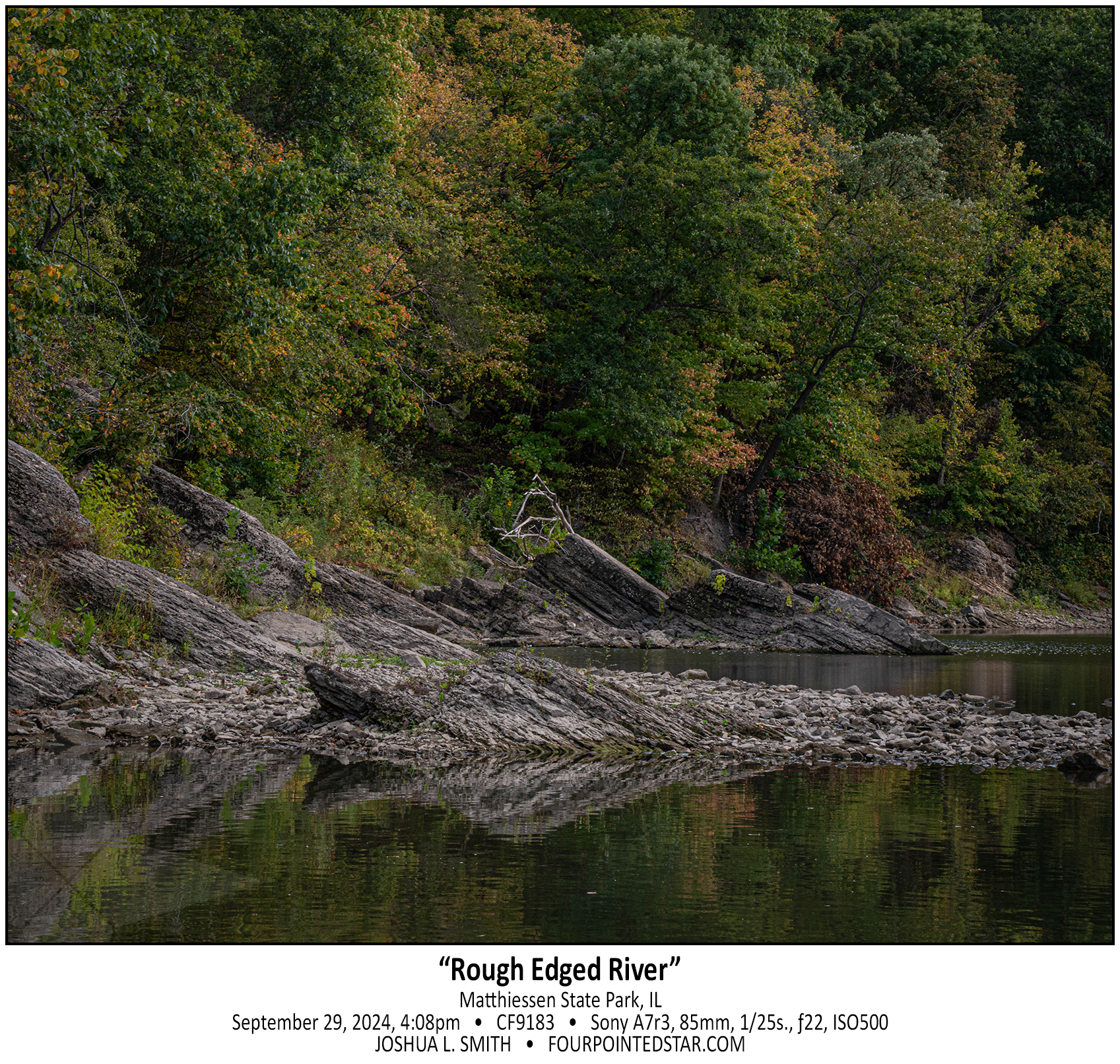
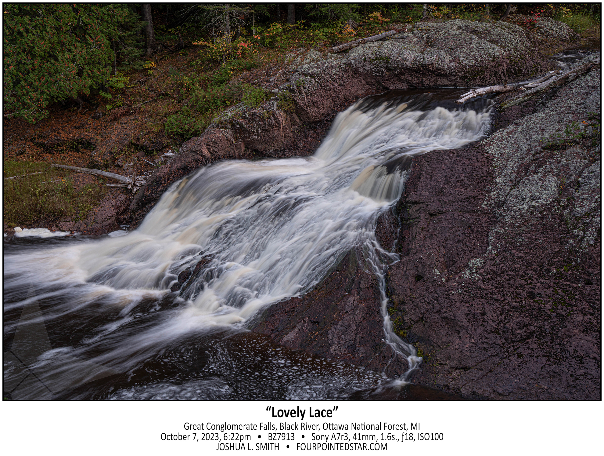
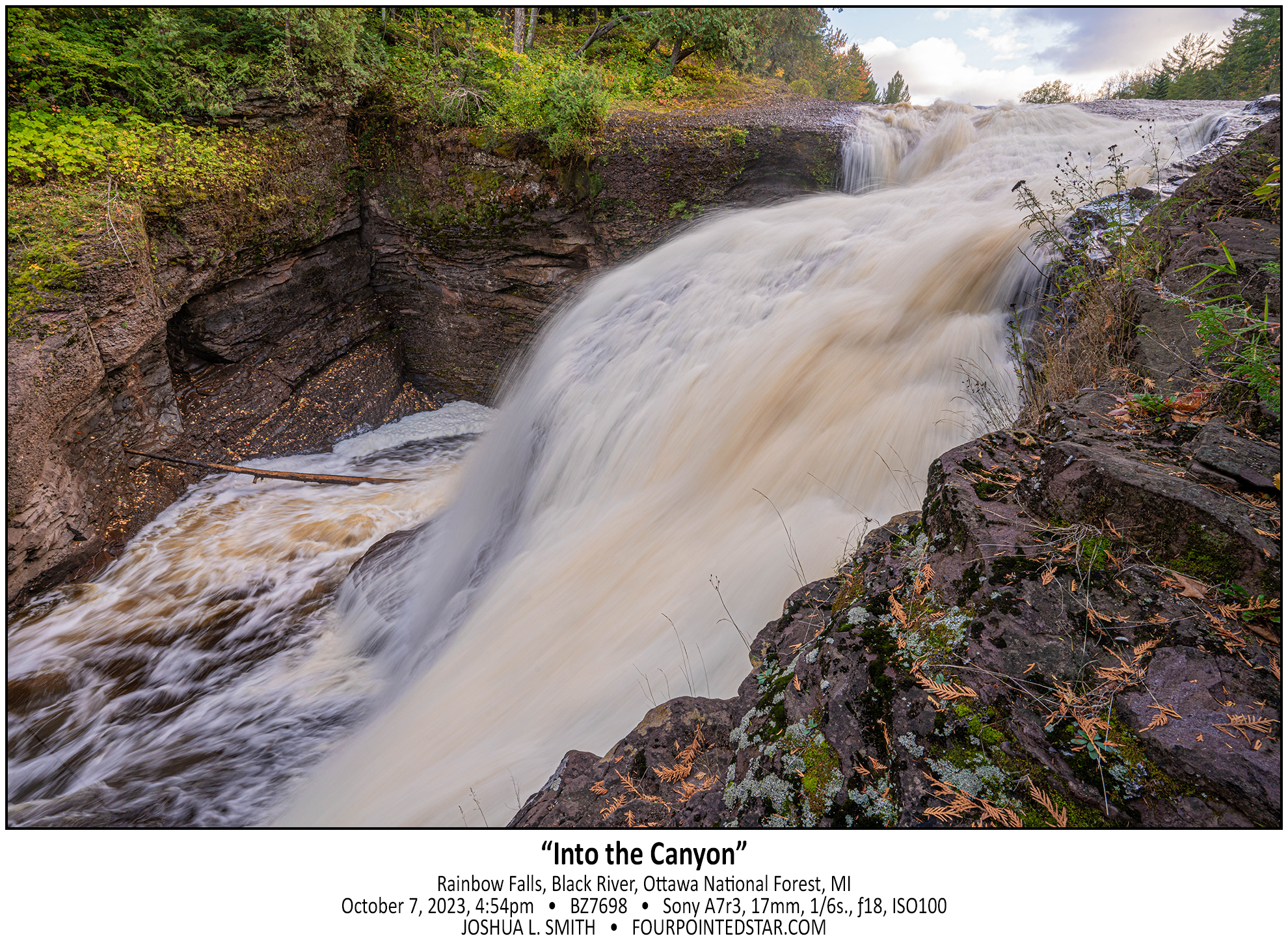
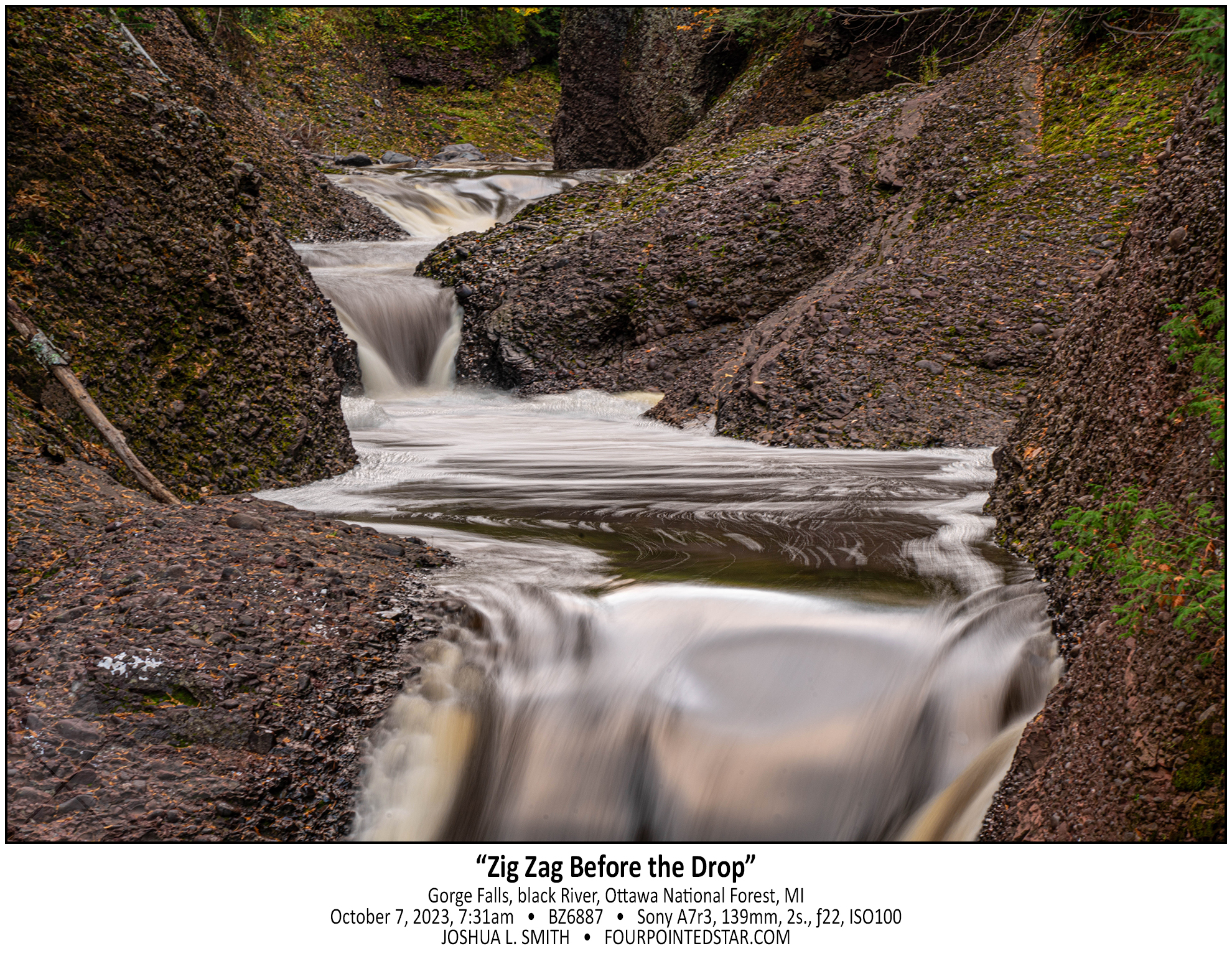
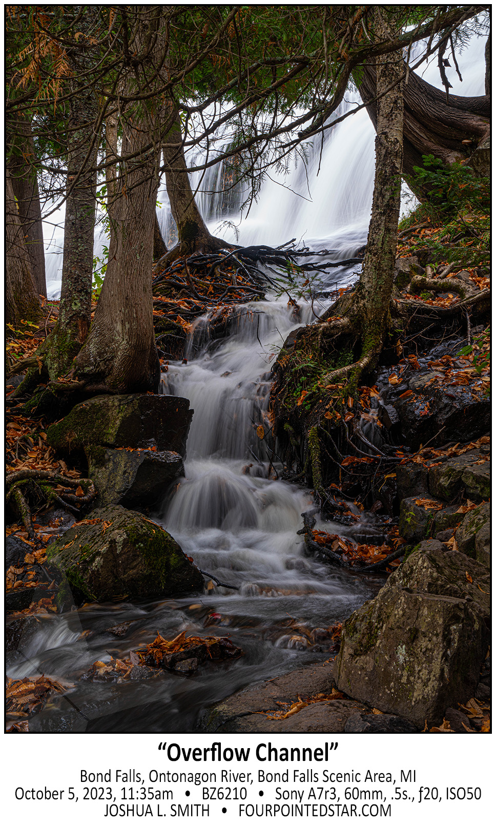
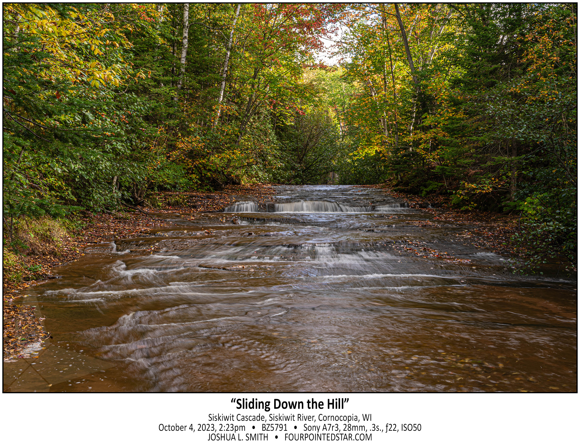
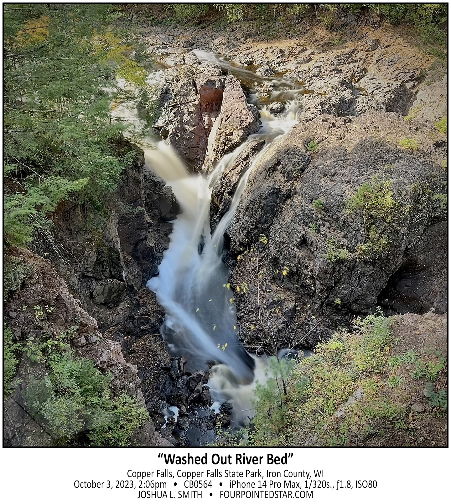
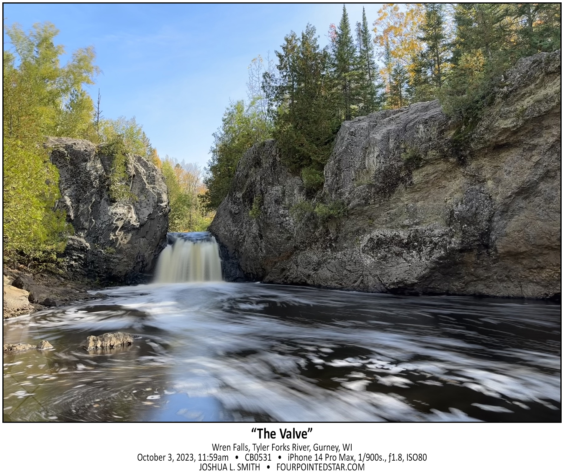
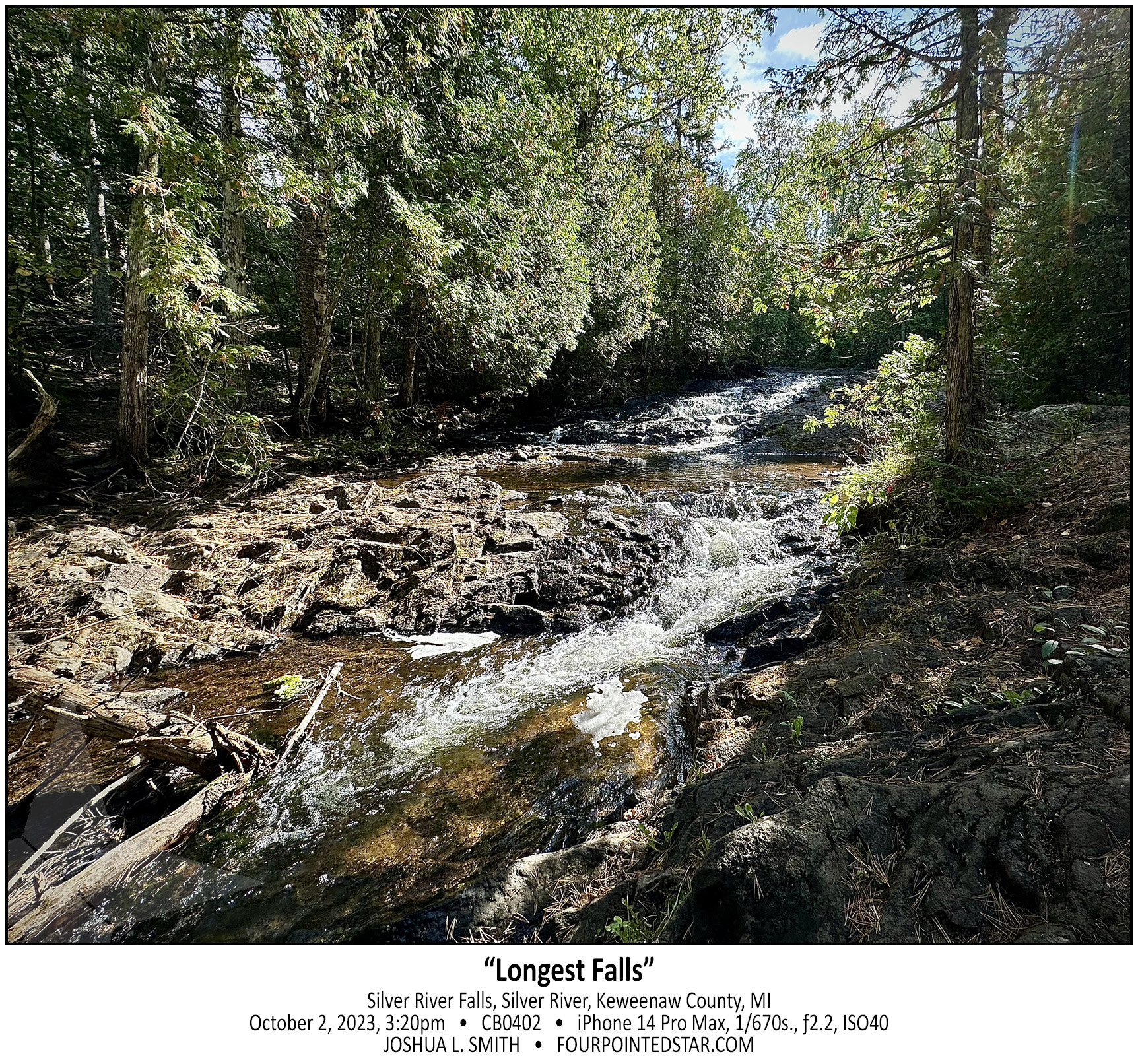
Oh man, where to start? This was “the story” from this trip; I saw so many very cool waterfalls, but this one, this one was interesting to find. My only directions for this location were that you turned down this particular forestry/logging road, and then “when the road forks, take the right side; the left side is VERY muddy after it rains. Once you cross the bridge, there is a pull over on the right side…” Well, it had just rained, so as I started down the glorified two-tracker, I watched for the fork in the road.

As I drove along it got muddier and muddier, but my Traverse has all wheel drive, so I wasn’t too concerned. Then I crested a hill and there was a small pool of muddy water at the bottom. Since there were tire tracks through it already, I assumed that there wasn’t anything dangerous in the water and I proceeded down the hill, through the mud, and then up the hill. As I crested the other side, there was another depression with more mud but just a little bit wider with more mud. Over the next 3 or 4 hills, each mud hole was a bit deeper and a bit wider.

As I crossed the 6th or 7th hill, the valley below was less of a small pool or muddy water, and almost a pond. It was at this moment that it occurred to me; not only have I travelled farther then the guide indicated, but now I have to turn around and head back through all of those increasingly deep mud puddles that I just made ruts in. Using my genius intellect, I assumed that the best way to avoid being stuck was to go as fast as possible through the puddles. There was one puddle where I felt the rear wheels gripping, but not the front wheels; but in each mud puddle, the Traverse came through.

So how did I find the waterfall? As I drove back on the two-track, I saw the “bridge” … a series of railroad ties laid across the road that I’d missed because I was looking for the fork in the road first.

CB0515

And yes, my wonderful white Traverse was a bit of a mess for the remainder of the trip. 🙂

CB0507

CB0501 231003 101834

I have 3 waterfall books that indicate that there is a waterfall or at least a larger rapids on this stream, and one of the books indicates that it is easy to reach. Without climbing down into the stream and then walking under the concrete culvert, I can’t tell if there is anything upstream. I also am VERY hesitant to walk upstream without knowing or seeing some indication that the land is still undeveloped at the least. So, this rapids/waterfall/something waits for another trip.

CF9169 240929 160325

CB0498 231003 095505

As I crested the hill so that I could see the rapids behind, I was literally awestruck by the view of Tyler Forks Dells Upper Falls. I gasped something like “that’s incredible!” as the scene came into view. The guide that I had stated “a series of small rapids forming an S curve”, but did NOT prepare me for how beautiful the Upper Falls are. The falls at the rear of the image are probably 200-250 feet away, which provides you with a sense of how expansive this view is. Although, you can’t tell it in this monochrome, the pops or orange leaves on the dark rocks, the yellow foaming water, and the sunlight illuminating the far side of the river added to beauty.

CB0484 231003 094527

As I walked up from the lower falls which were not very impressive but were very easy to get to; I realized that the land was increasing in height but the river was not. And as this break in the stone cliff came into view, I could tell that Tyler Forks Dells might be quite the sight. But first I had to cross this rock wall that was maybe 15 or 20 feet high.

CB0473 231003 093656

BZ4527 231003 084706

Upson Falls tumbles over the cascade of rocks and immediately makes a sharp right turn downriver. That sharp turn allows for this spectacular view with the sun rising “up river” and the wonderfully rich hues of morning.

CB0412 231002 170232

BZ4430 231002 145938

The Keweenaw Peninsula does not have much land area for large rivers to form, and this is reflected in some of the waterfalls. Manganese Falls is a very steep fall, but the stream is only 10-12 inches wide.

CB0402 231002 152018

Silver River Falls is another very accessible waterfall. Michigan Highway 26 crosses over the Silver River and there is information describing the falls and the bridge along with some parking. However, Silver River Falls isn’t one cascade; it is a series of several small cascades spread along a few hundred feet of the Silver River. This photo was taken 150 feet or so down the river and there were more cascades further downriver as well.

CB0396 231002 143242

As you climb up the hill beside Jacob’s Falls, the question may cross your mind: “does this all count as one waterfall?” And that is a question that I have wondered many times; how much of a stream’s length must exist between cascades of water before they are considered distinct falls?

CB0388 231002 142544

Jacob’s Falls is kinda the perfect Upper Peninsula waterfall. It’s small and unassuming, but literally 20 feet away from the edge of the road. There would be people like myself who would search it out if it were hidden in a forest, but really, the reason that it has a name is because of the highway.

CB0386 231002 141057

You can easily view this dam and falls from a pedestrian bridge over the Eagle River, and as I stood on that bridge, I was impressed by the manmade dam that has stood for (I assume) nearly a century or more. But I was also saddened that I will never see this waterfall tumbling down the rock face with the intensity that nature intended.